South Florida Drone Guys
COMMERCIAL PROGRESS REPORTS
561-699-9122
Commercial | Residential | Industrial | Insurance Claims
South Florida Drone Services can add a stunning perspective to your next commercial or industrial project. We provide aerial photography and aerial video content for your project by utilizing the latest in drone technology and ultra high-resolution cameras from our FAA licensed pilots and FAA registered drones.
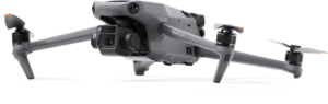
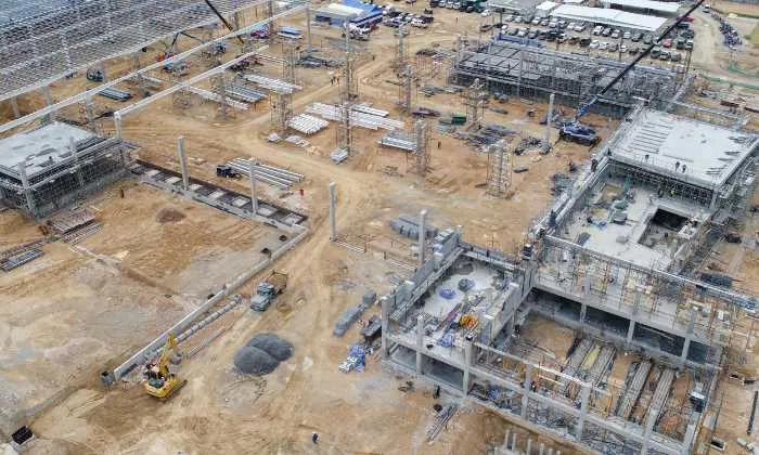
Commercial Construction Drones
Drone technology is being used extensively in the construction industry to collect real-time data about projects and understand what’s going on on the job site. Aside from providing hourly, weekly, or monthly information about a site, drones also improve safety and save time and resources by detecting problems early before they become costly or add weeks to a project’s timeline.
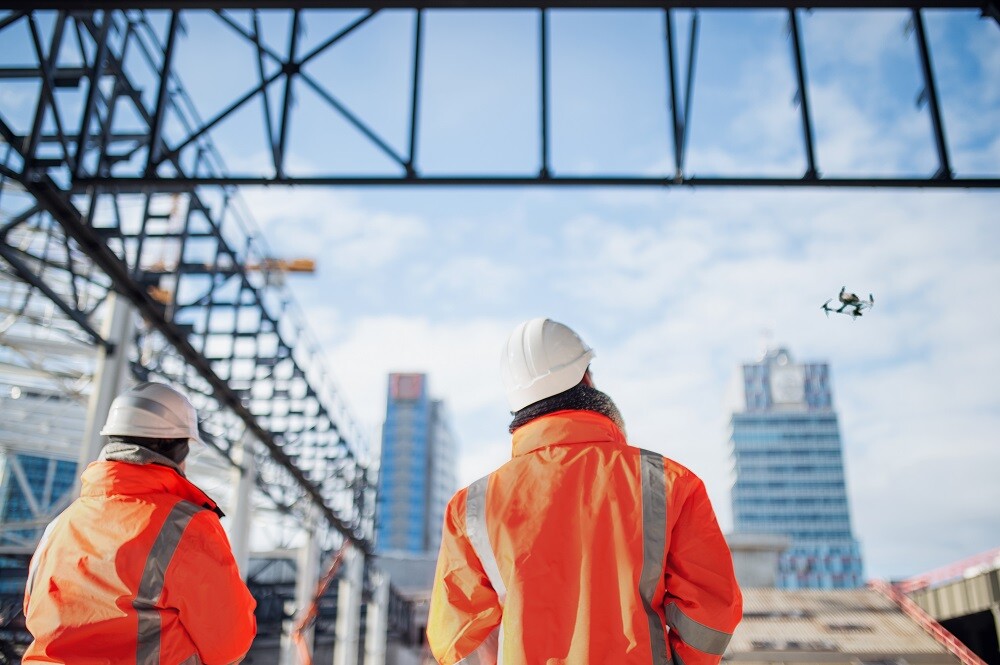
Why Drones In Commercial Construction
Drones are extremely popular in the construction industry because they provide an aerial view of a site at a fraction of the cost of construction. This means they can be used to create plans, track progress, and track any issues that arise during the construction process.
Drones are used to conduct detailed surveys, measure, demarcate, and geo-reference the area, as well as capture aerial photographs and videos and create metro maps. Mining sites use industrial-grade drones for surveying, asset inspection, terrain mapping, stockpile estimation, security, and surveillance.
All information below is provided to you on your own webpage which is updated each time a visit is made to your site. Everything is in one place for you and your team to see the progress on your job site. This information can be passed on to your investors and managers saving time and money visiting the site leave it upto South Florida drone Guys to handle your jobe site visits on a regular basis whether it be weekly bi-weekly or monthly let us handle your visits for you. Contact me Steve for any question 561-699-9122
Commercial Progress Reports
Drones are increasingly being used in commercial settings for various tasks, such as inspections, surveying, delivery, and aerial photography. Progress reports help organizations track the progress of drone operations and gather important information about the performance and efficiency of their drone fleet. This information can be used to make data-driven decisions about the deployment of resources, the allocation of budgets, and the improvement of operations. Additionally, progress reports can help organizations identify areas for improvement and optimize their drone operations for better results.
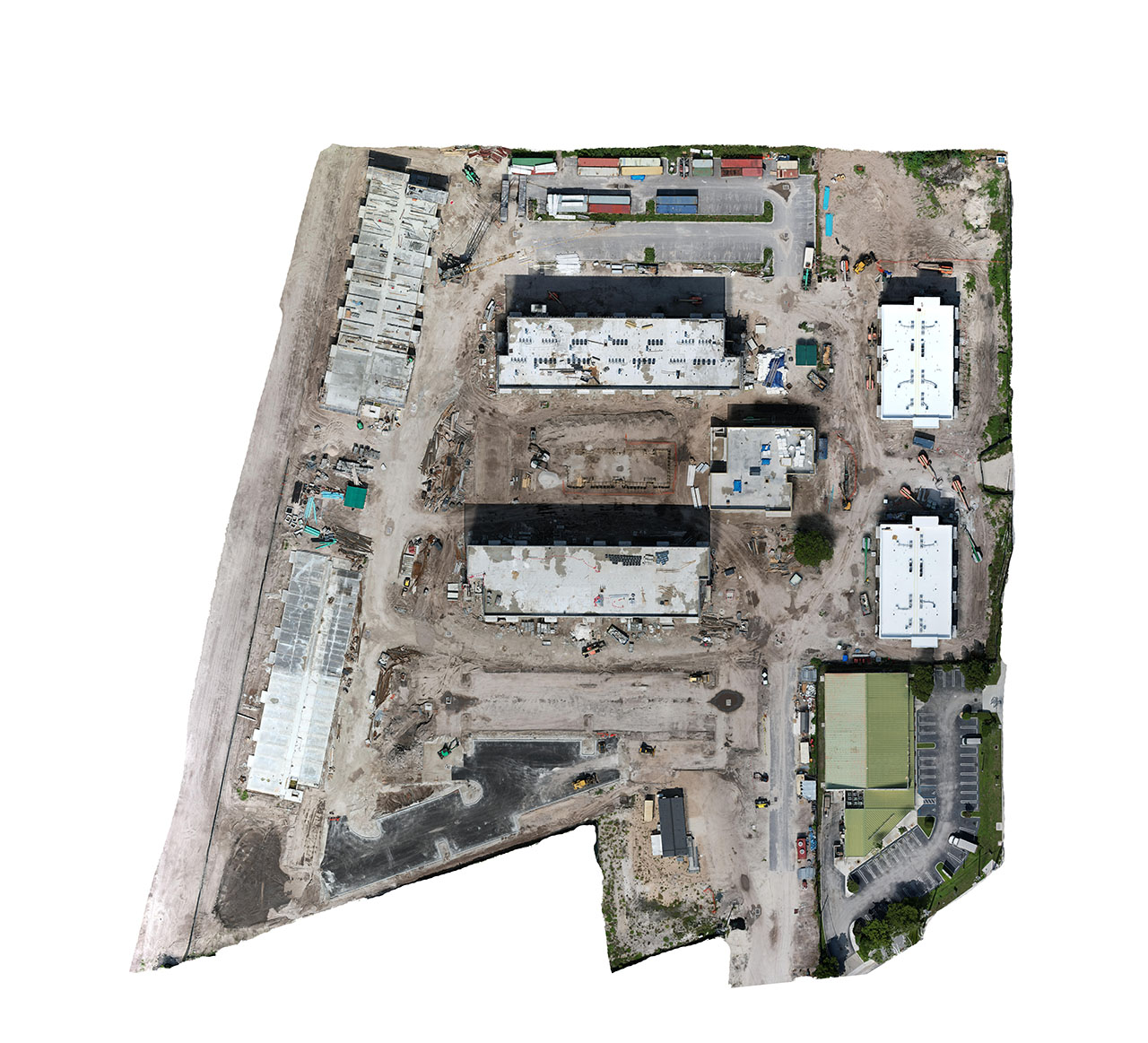
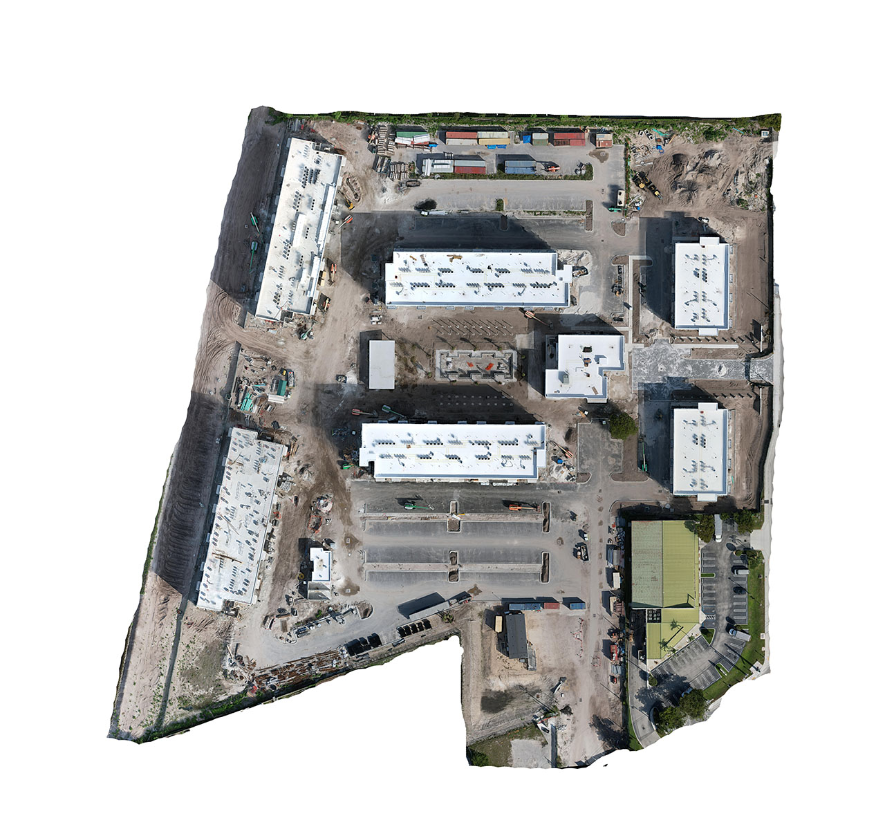
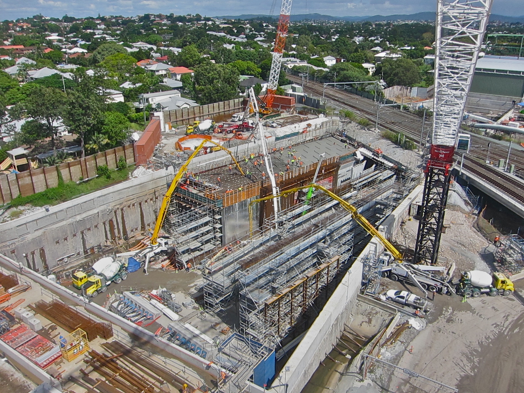
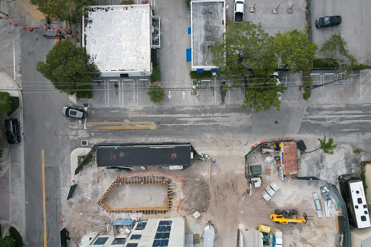
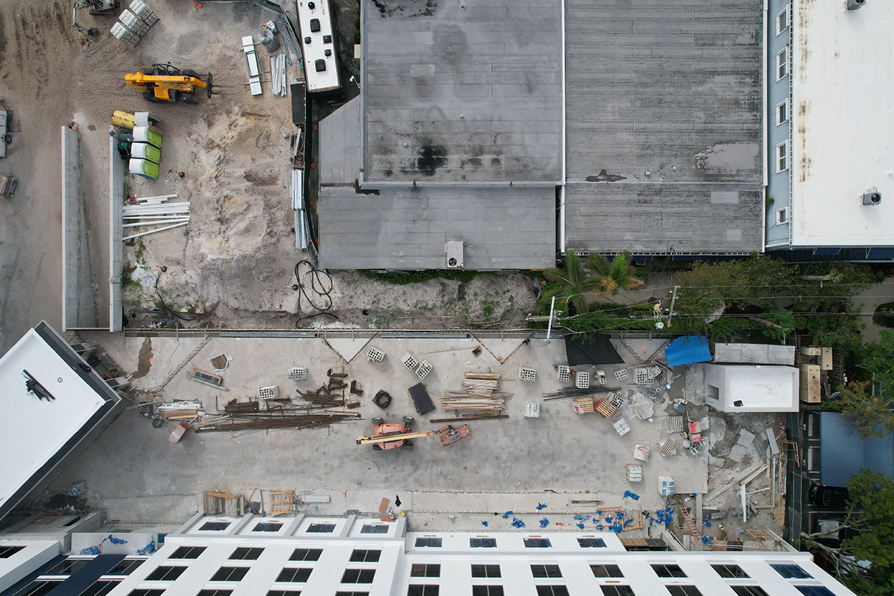
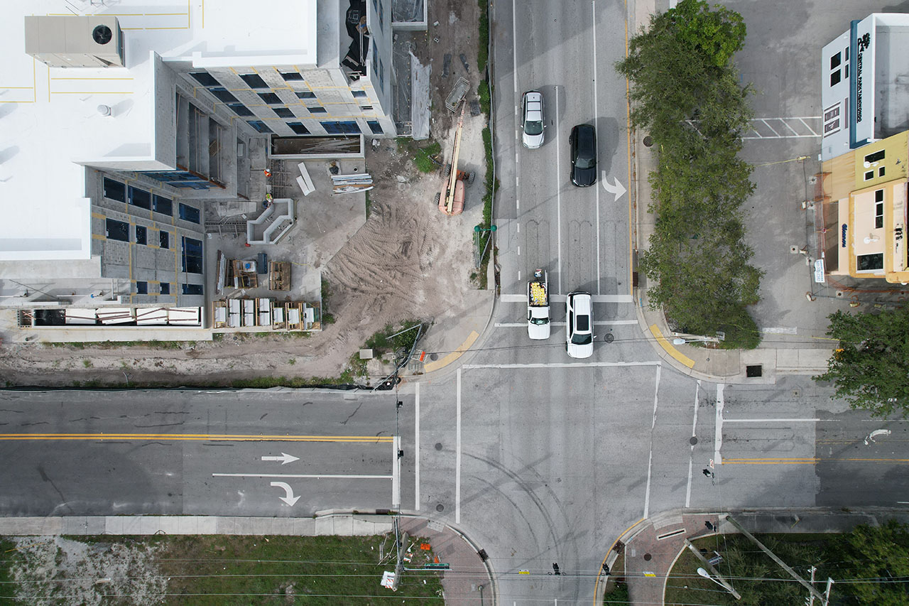
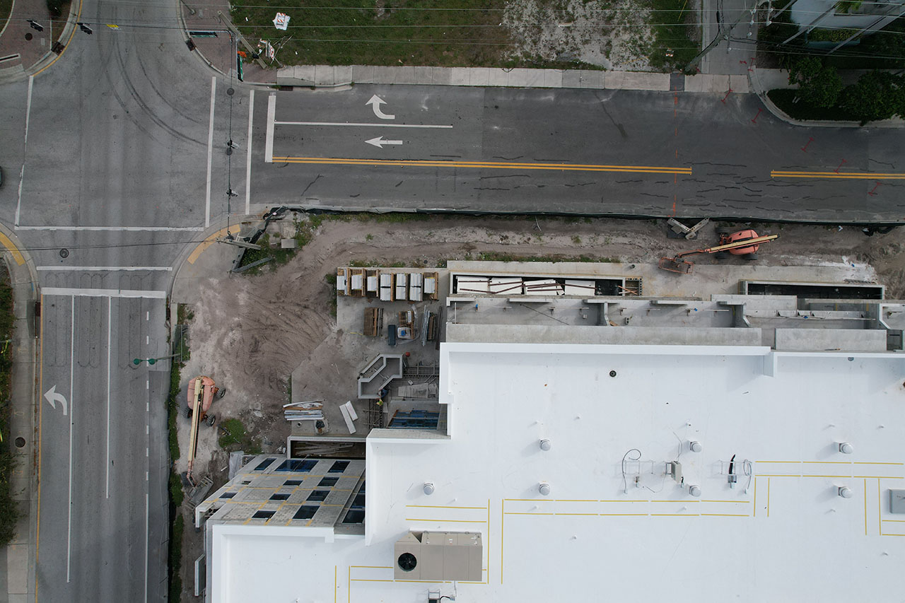
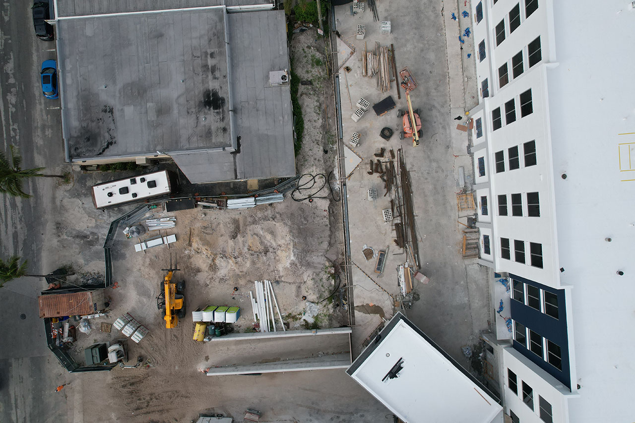
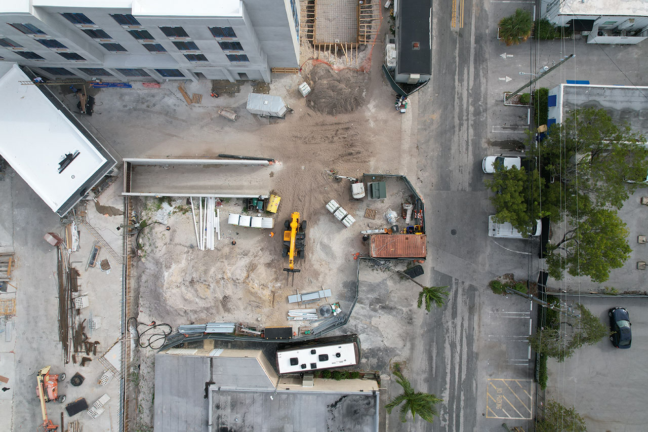
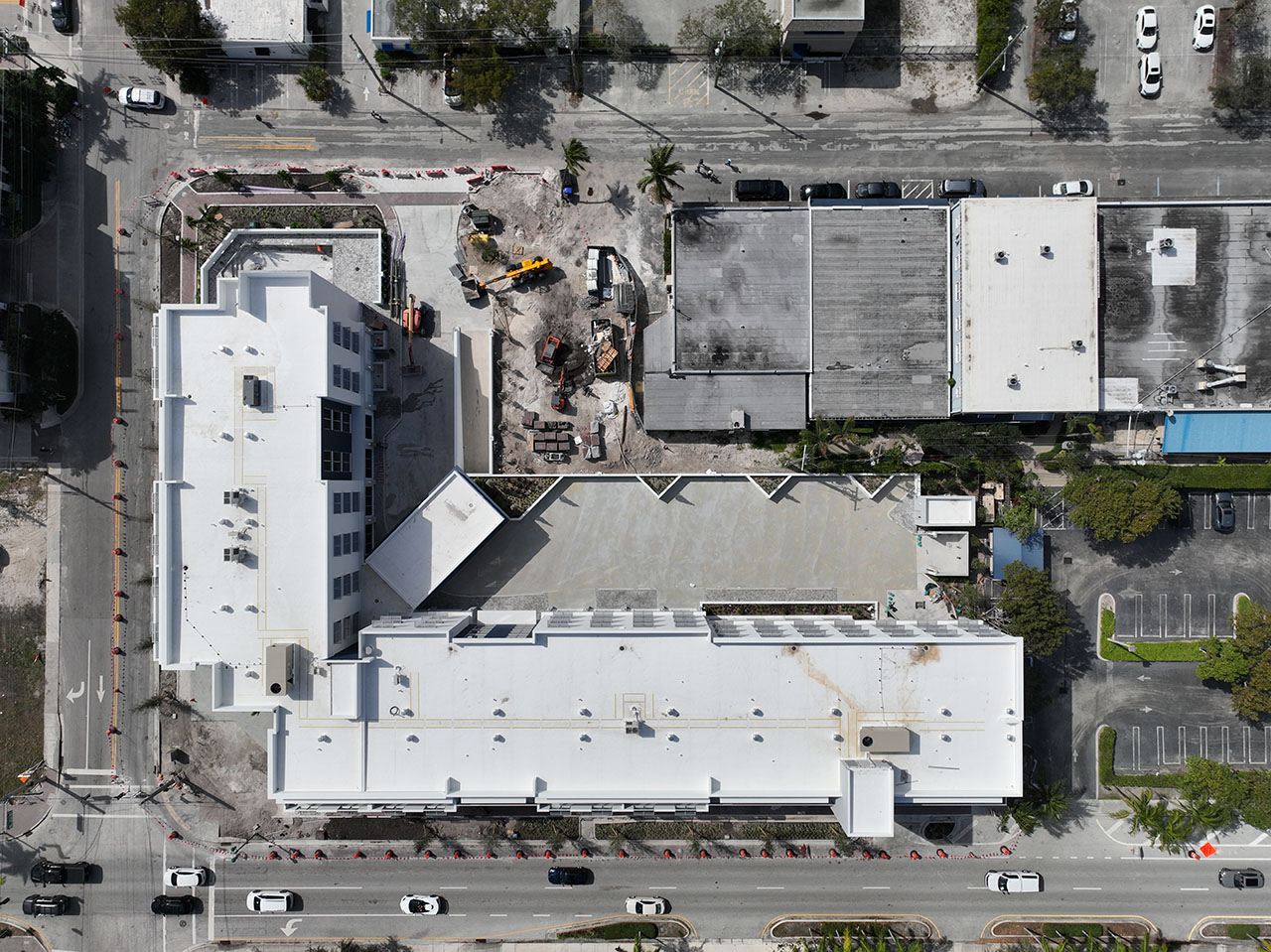
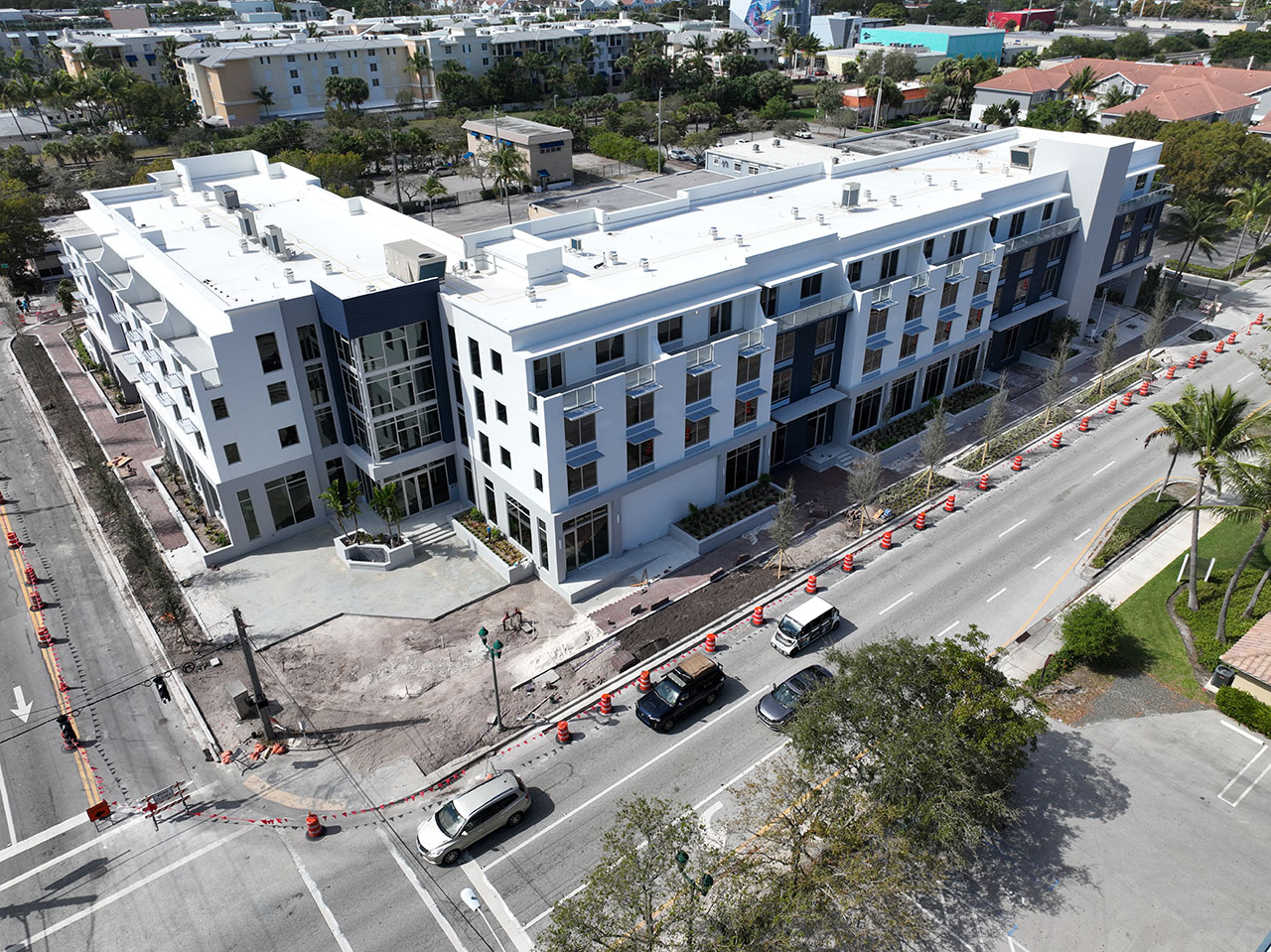
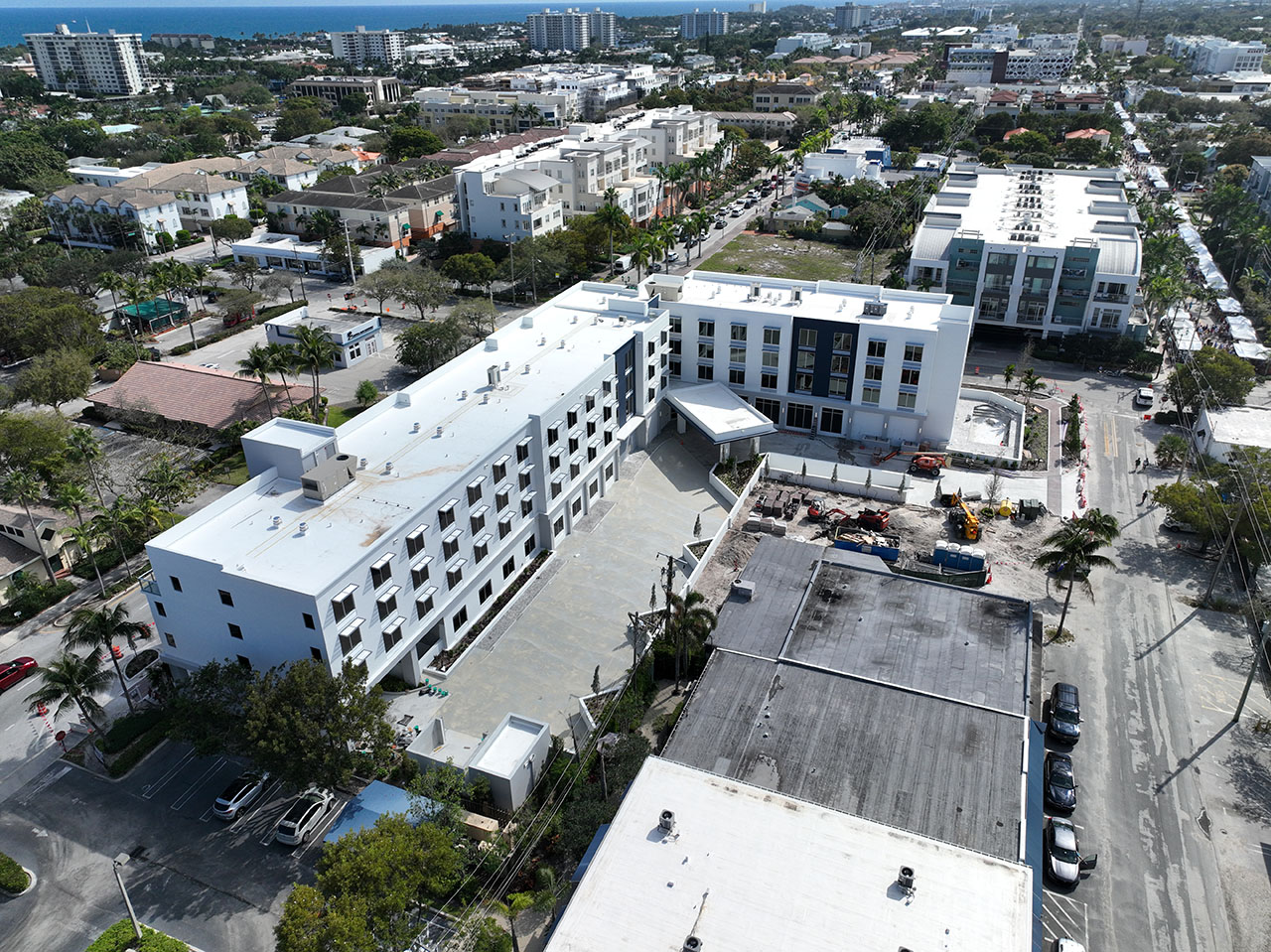
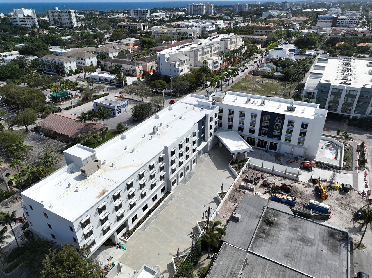
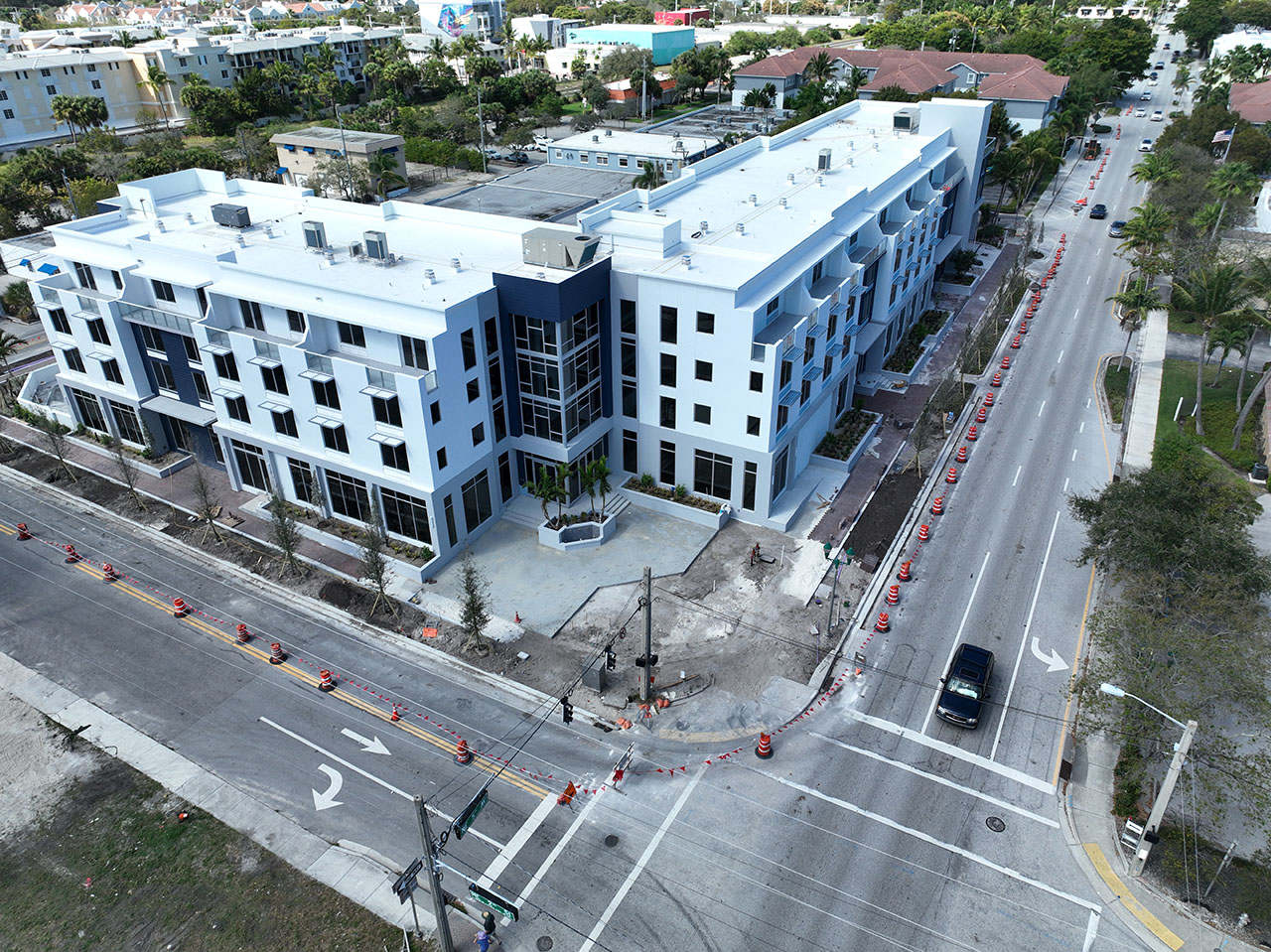
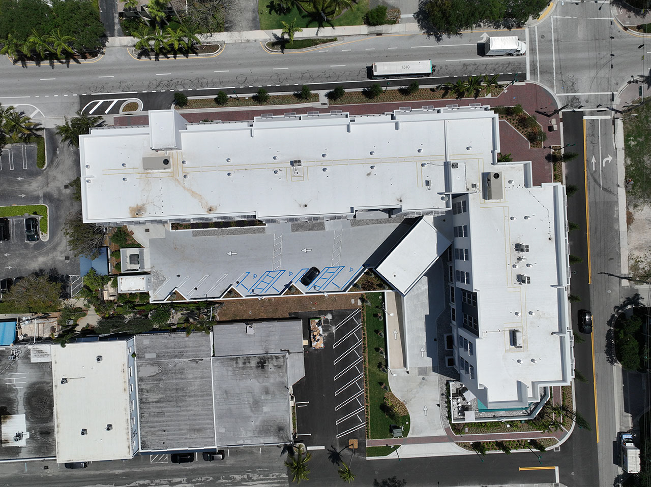
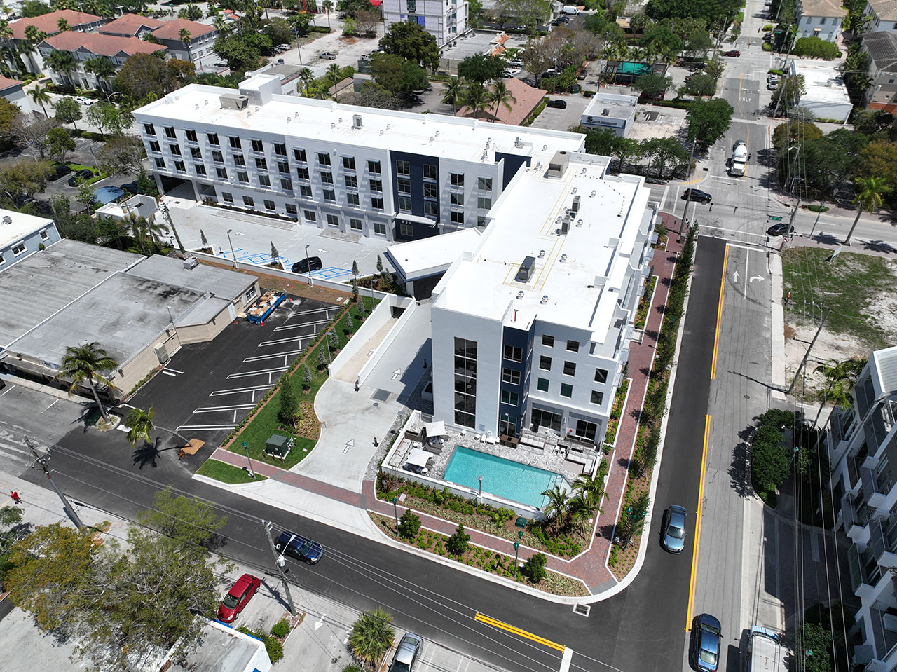
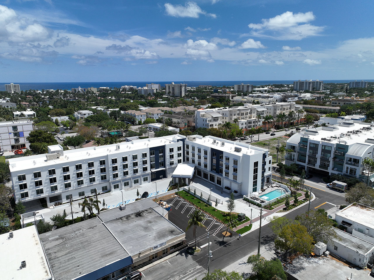
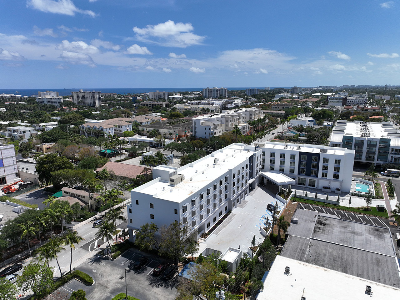
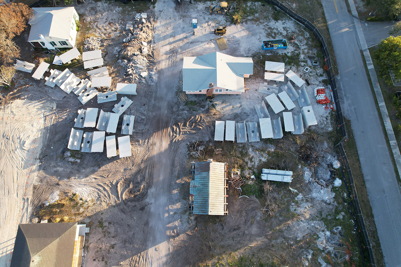
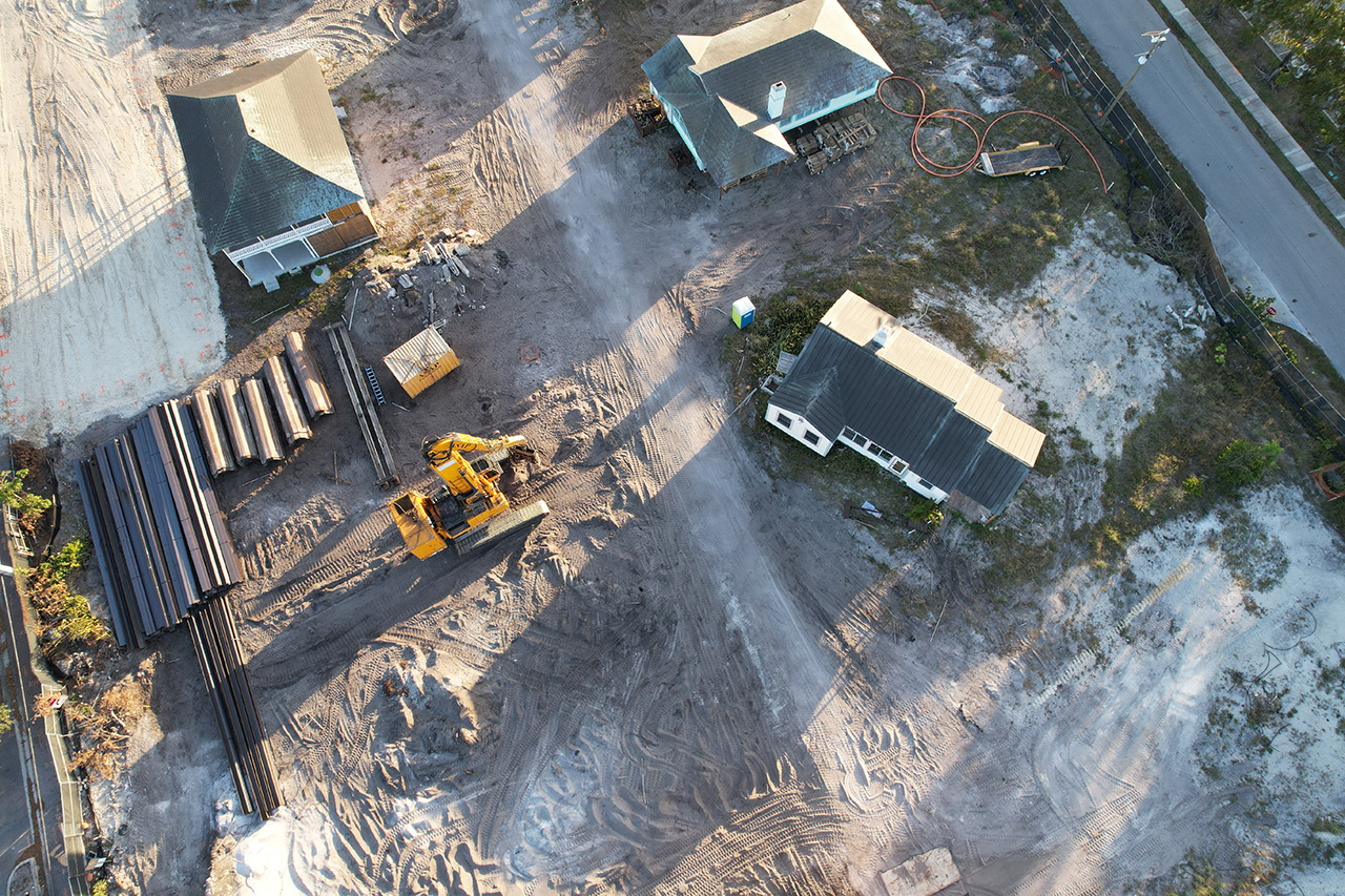
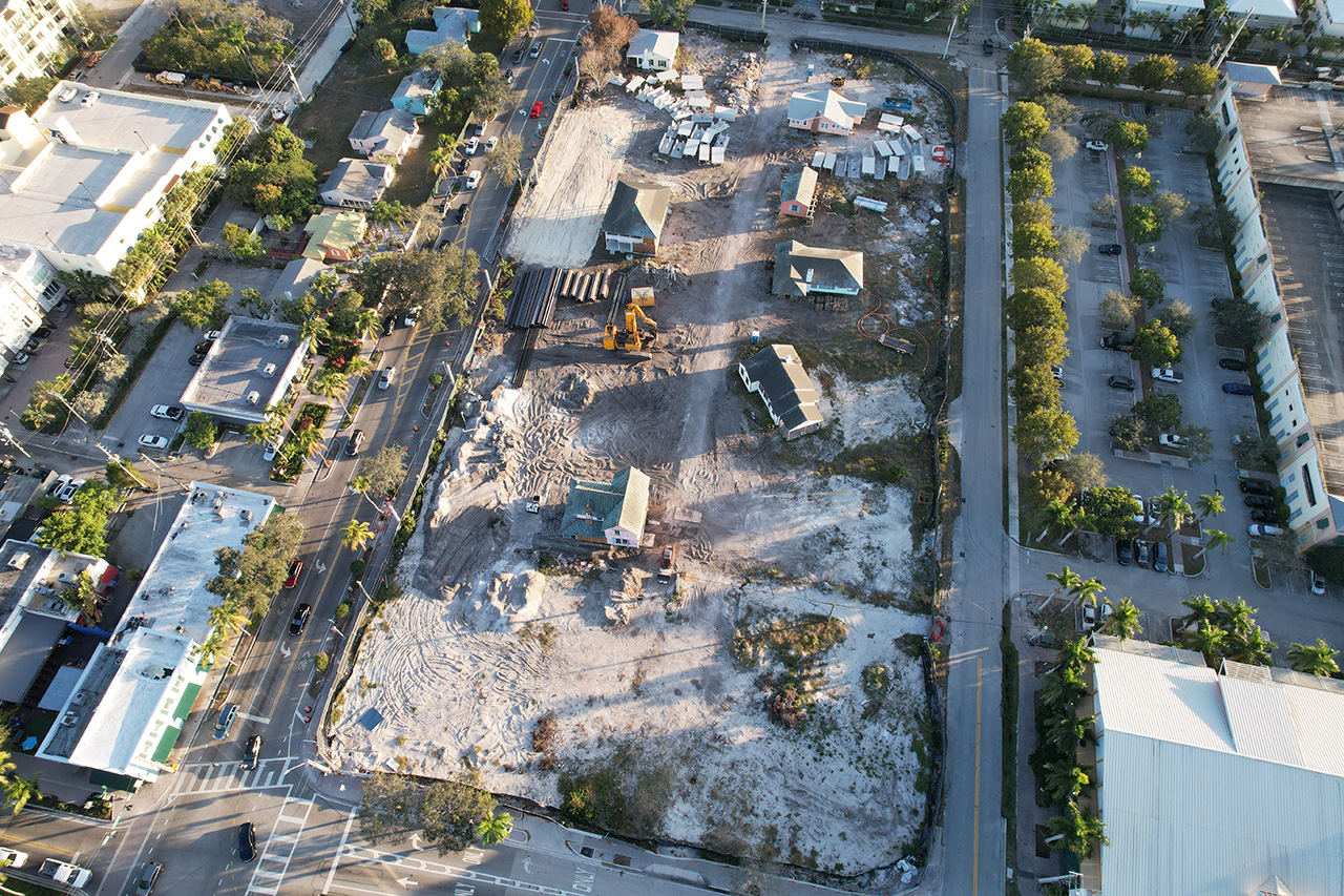
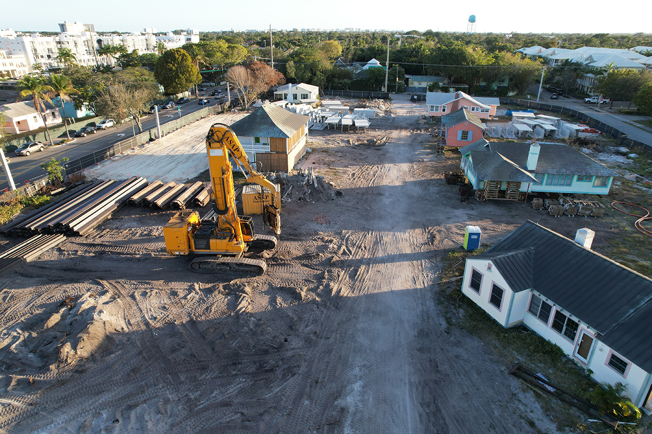
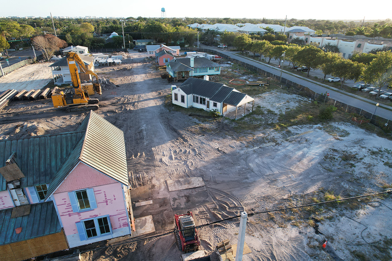
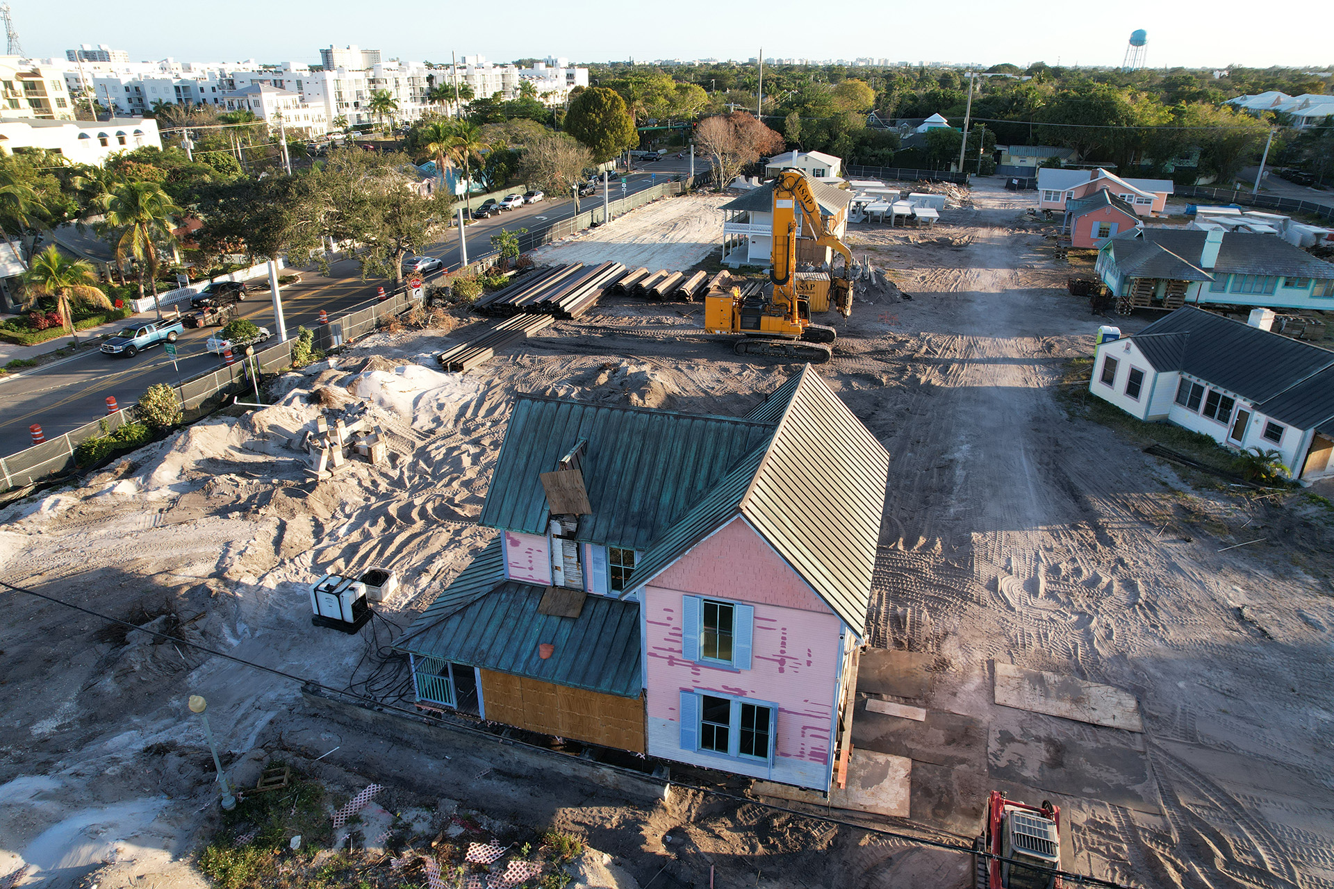
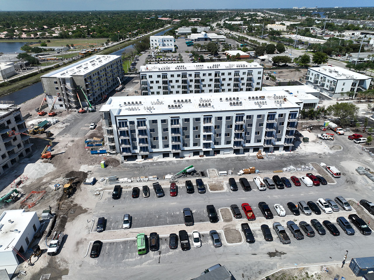
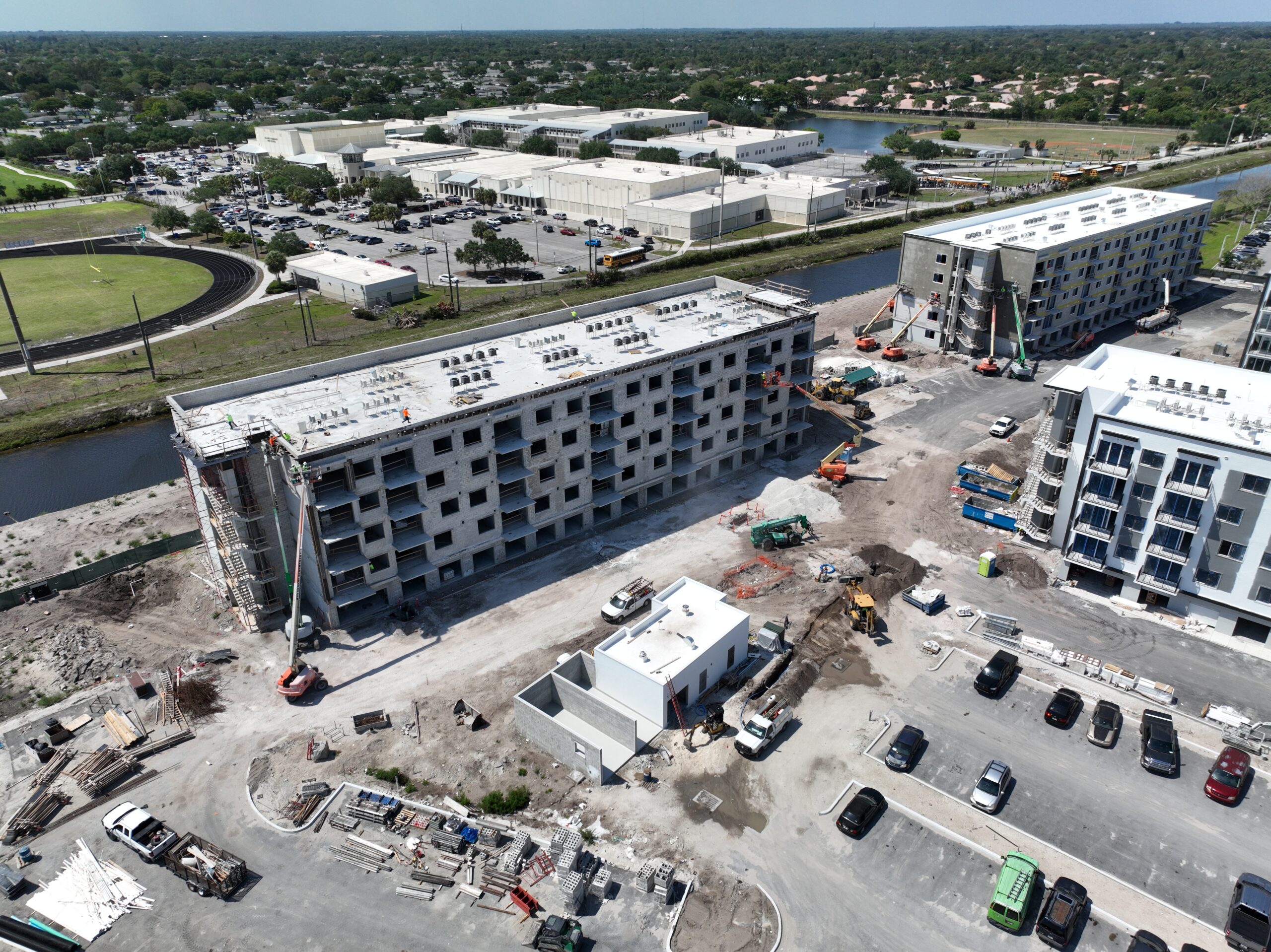
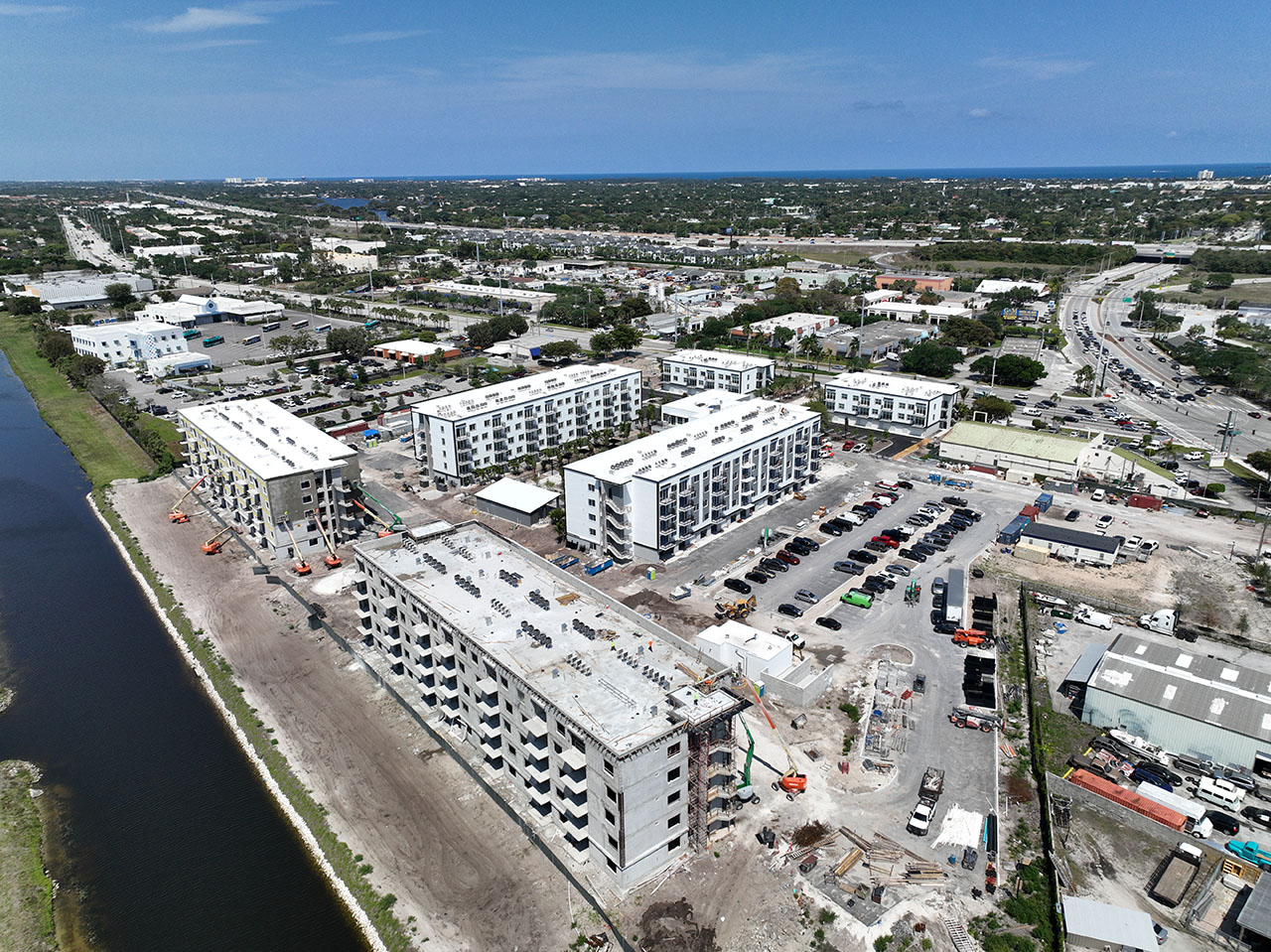
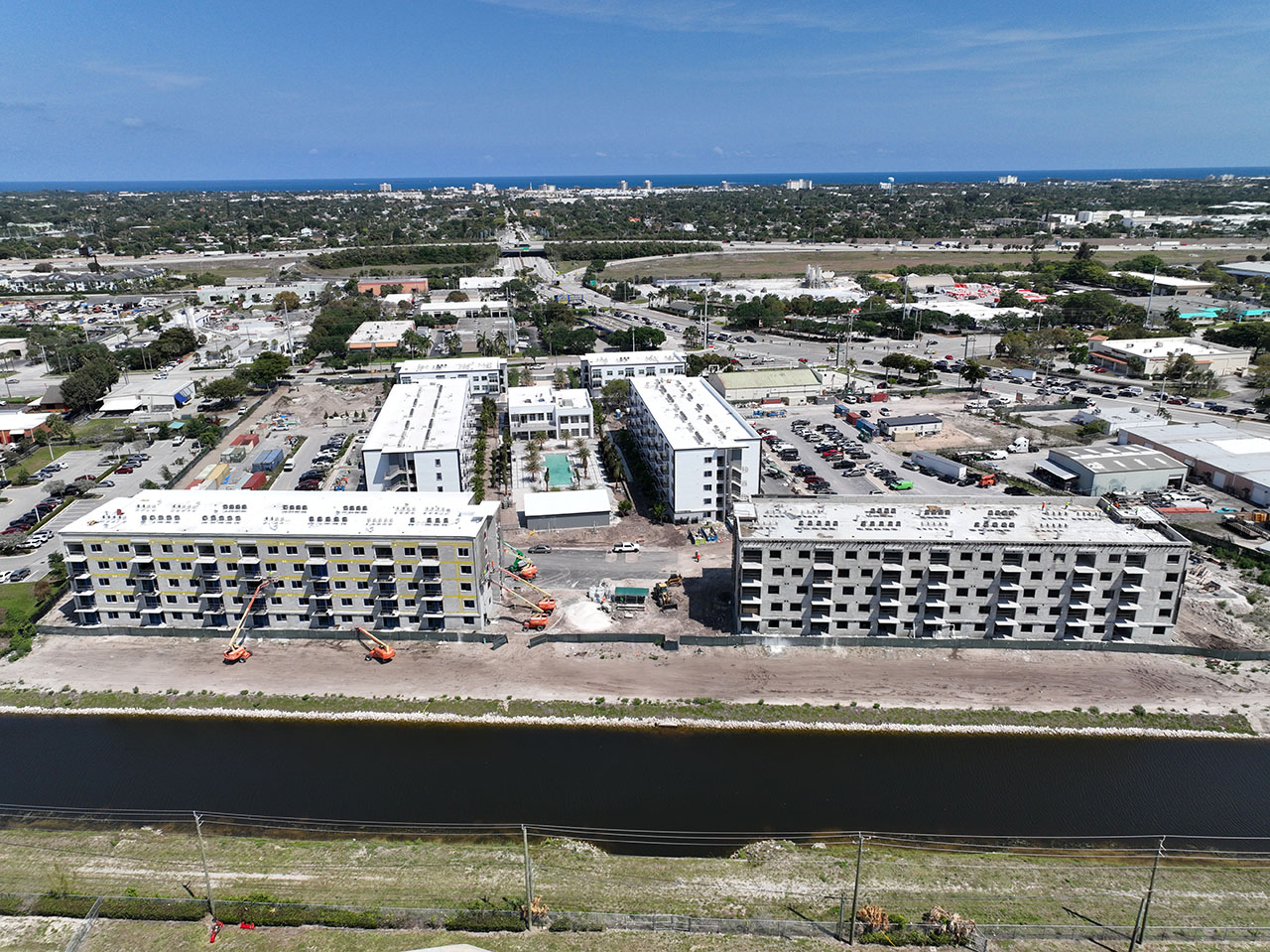
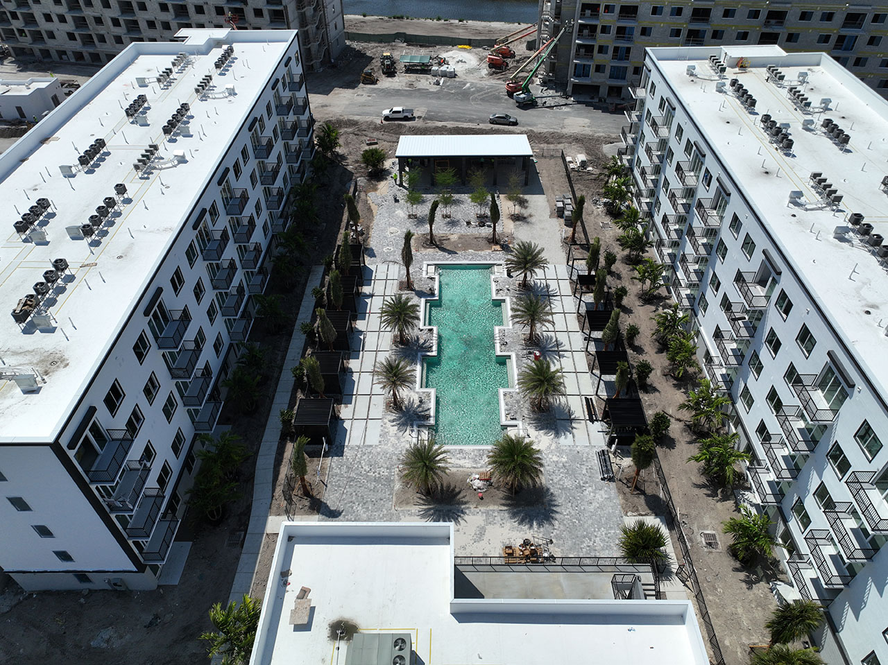
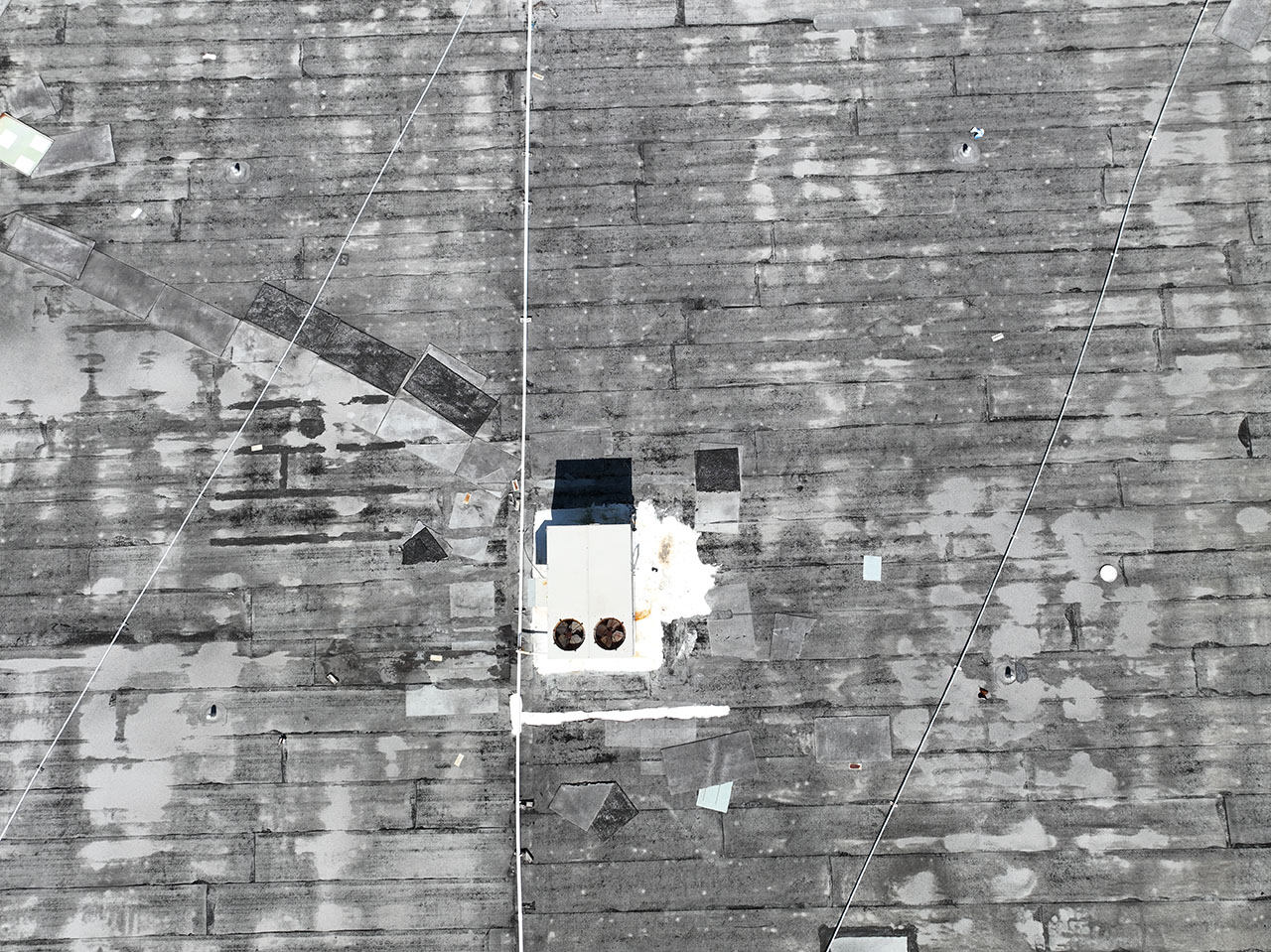
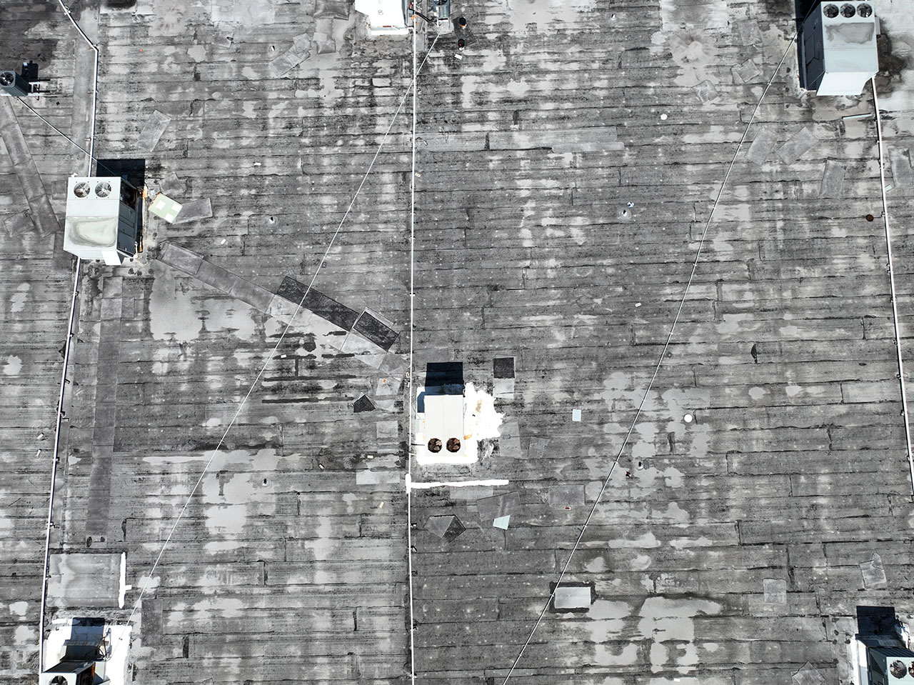
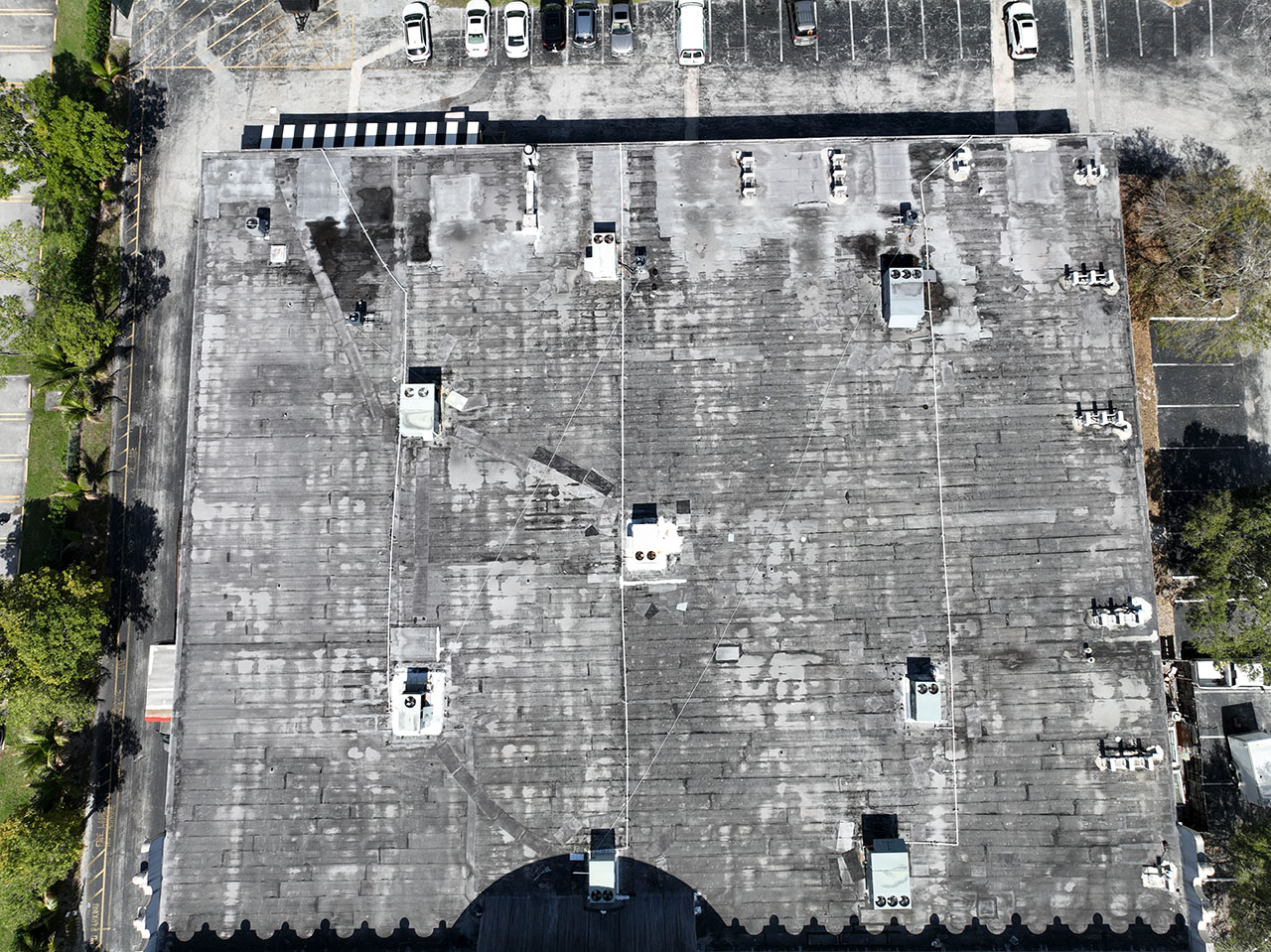
Commercial Progress Photo And Video Reports
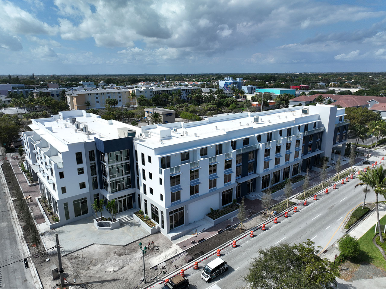
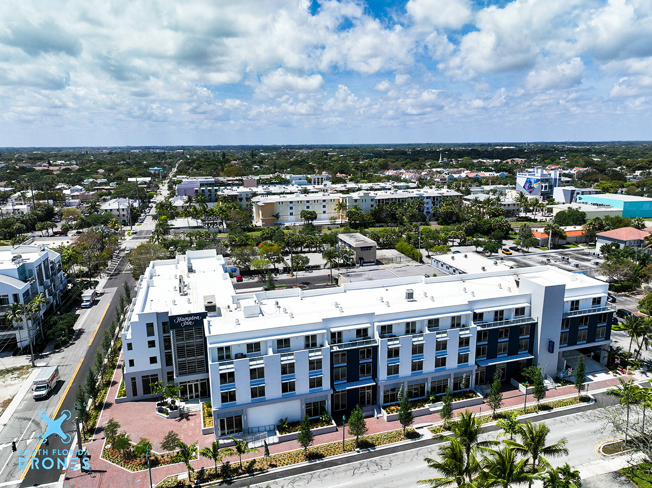
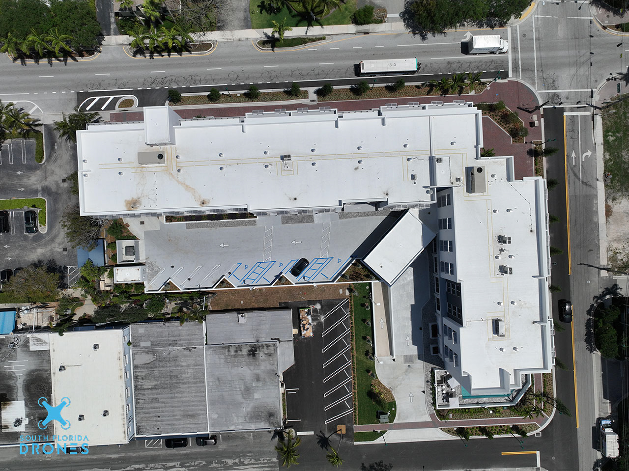
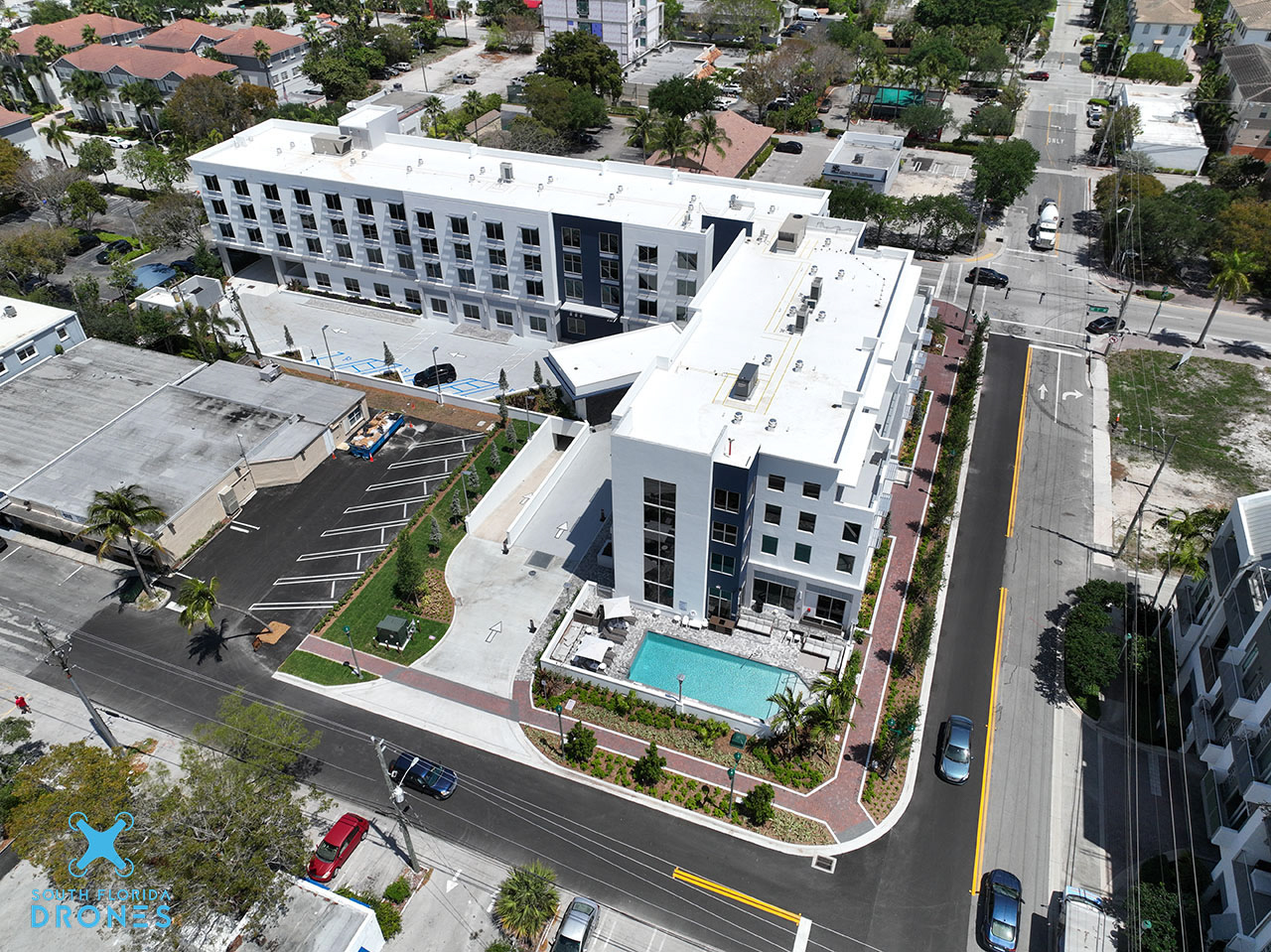
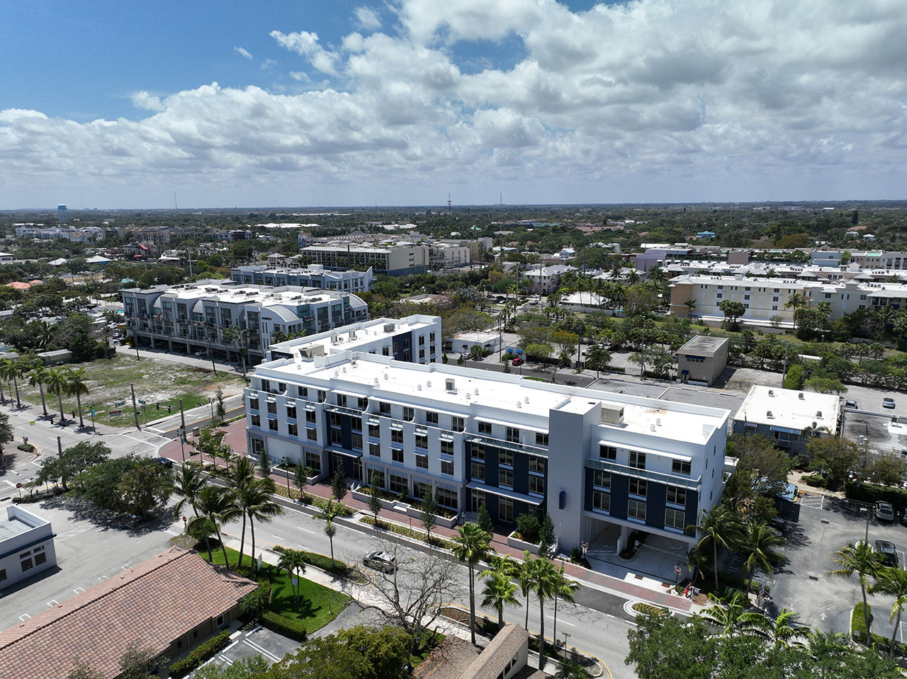
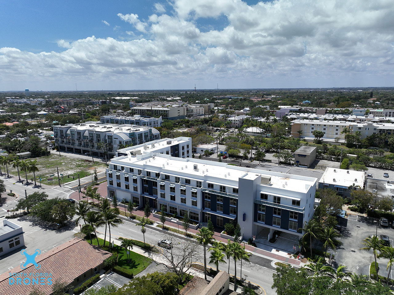
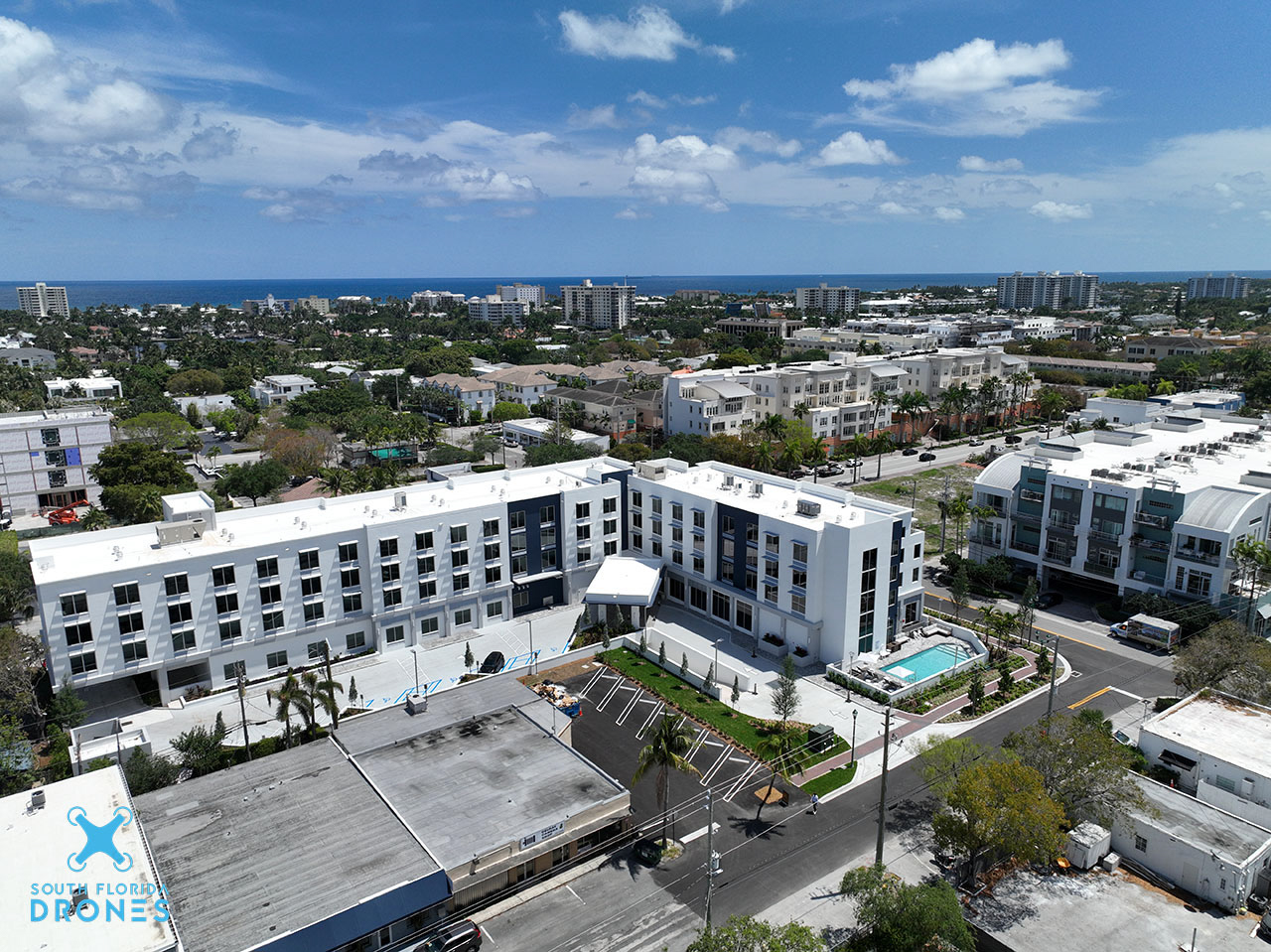
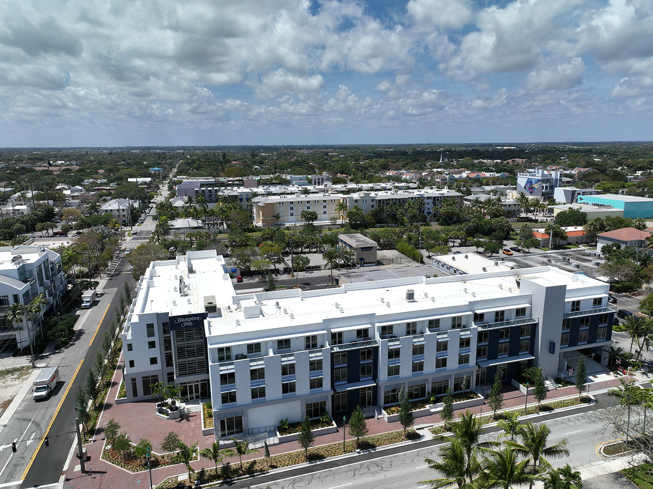
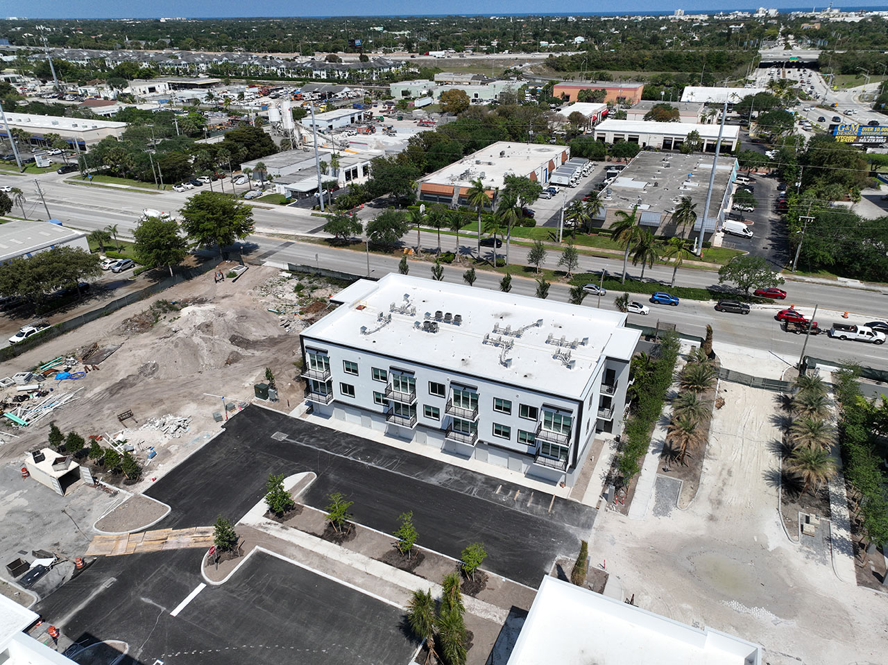
Commercial Progress Photo Reports
SUNDY VILLAGE DOWNTOWN DELRAY BEACH
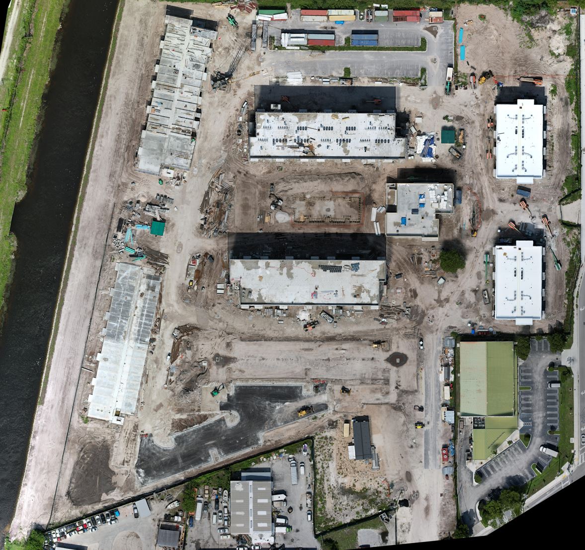
Commercial 3D Reports Of Site Below
To Move Map Hold Shift Key While Using Mouse
LEARN MORE HERE
The Map Above Is A Great Tool To See Details On Your Site Progression
3D mapping is an essential tool for construction progression as it allows for accurate and comprehensive visual representation of the construction site. By creating a 3D model of the construction area, builders and engineers can better plan and coordinate their work, identify potential challenges and opportunities, and make more informed decisions throughout the construction process. This technology also enables teams to detect errors or inconsistencies before they occur, helping to save time and resources. Overall, 3D mapping improves efficiency and accuracy in construction, ultimately leading to successful completion of projects.
With 2D maps like the one below you are ablr to use the included tools to measure stock piles and use the ruler tool to measure distance. Check out the 2D map below and play around with the tools on the left of the map
Commercial Before And After
View Progress over time for your project with my Before And After Sliders
Commercial 2D Map Report
CLICK HERE FOR A FULL SCREEN VIEW OF THE 2D MAP
LEARN MORE HERE
Commercial Progress Video Reports
Why Is It Important For Video Progress Reports For Your Site
LEARN MORE HERE
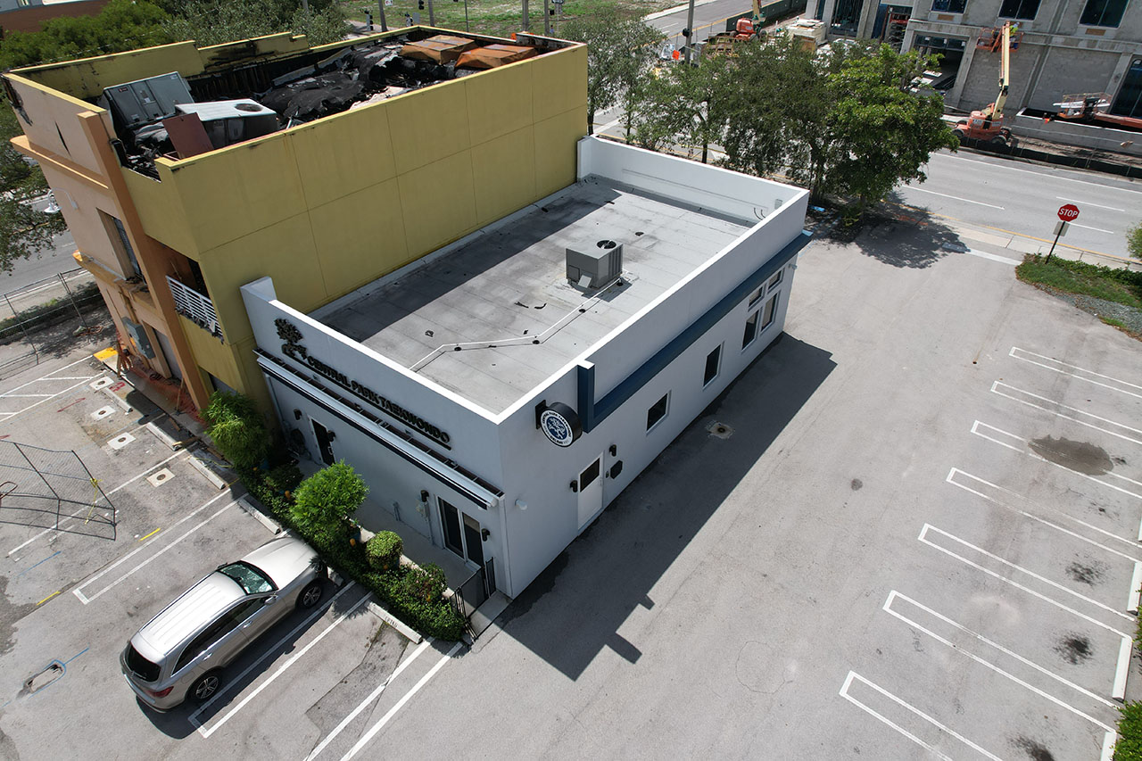
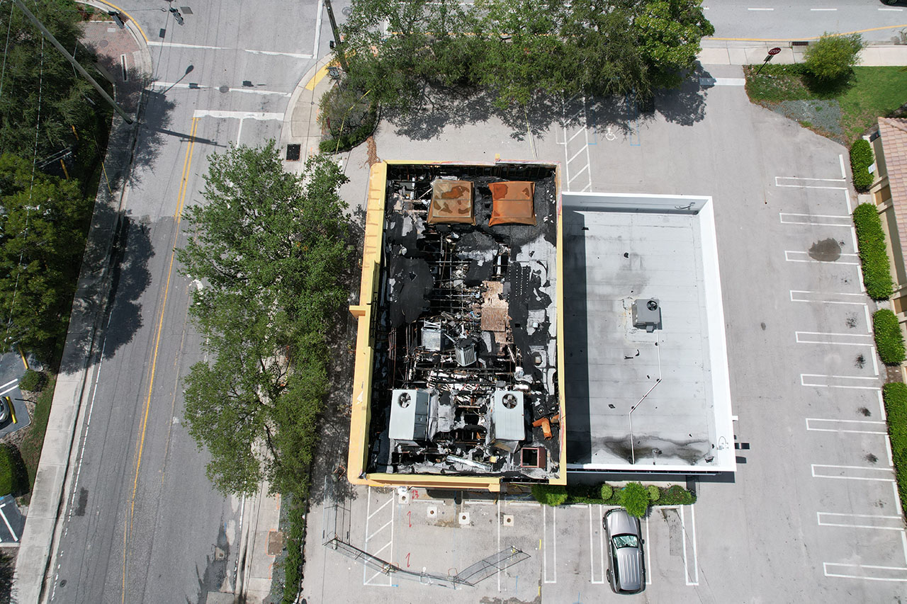
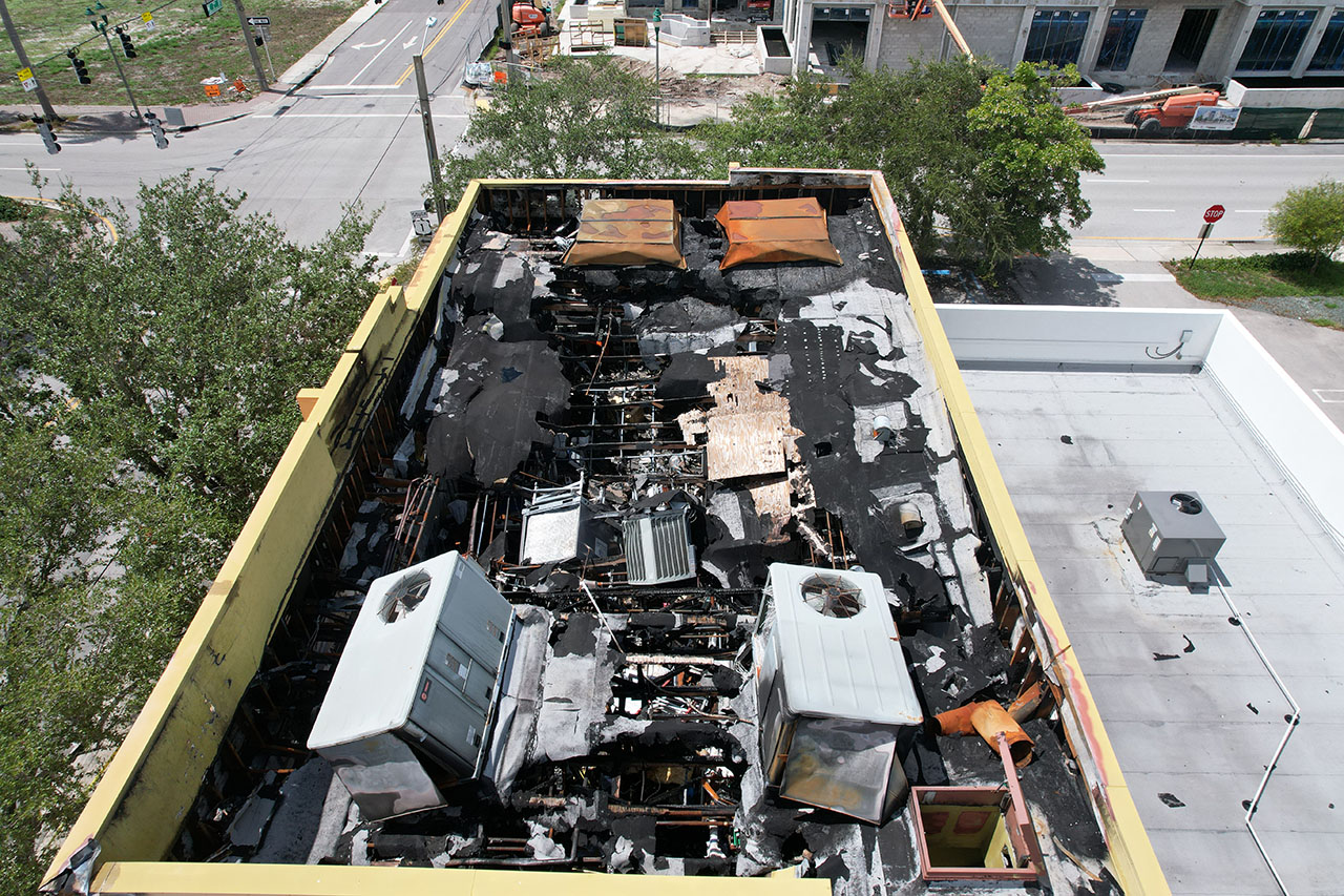
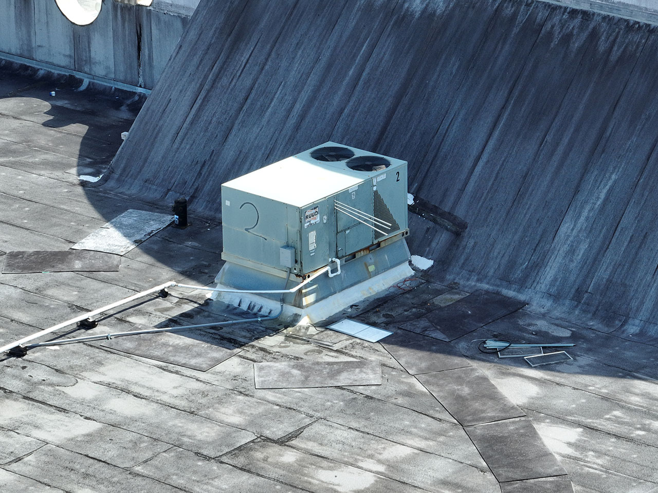
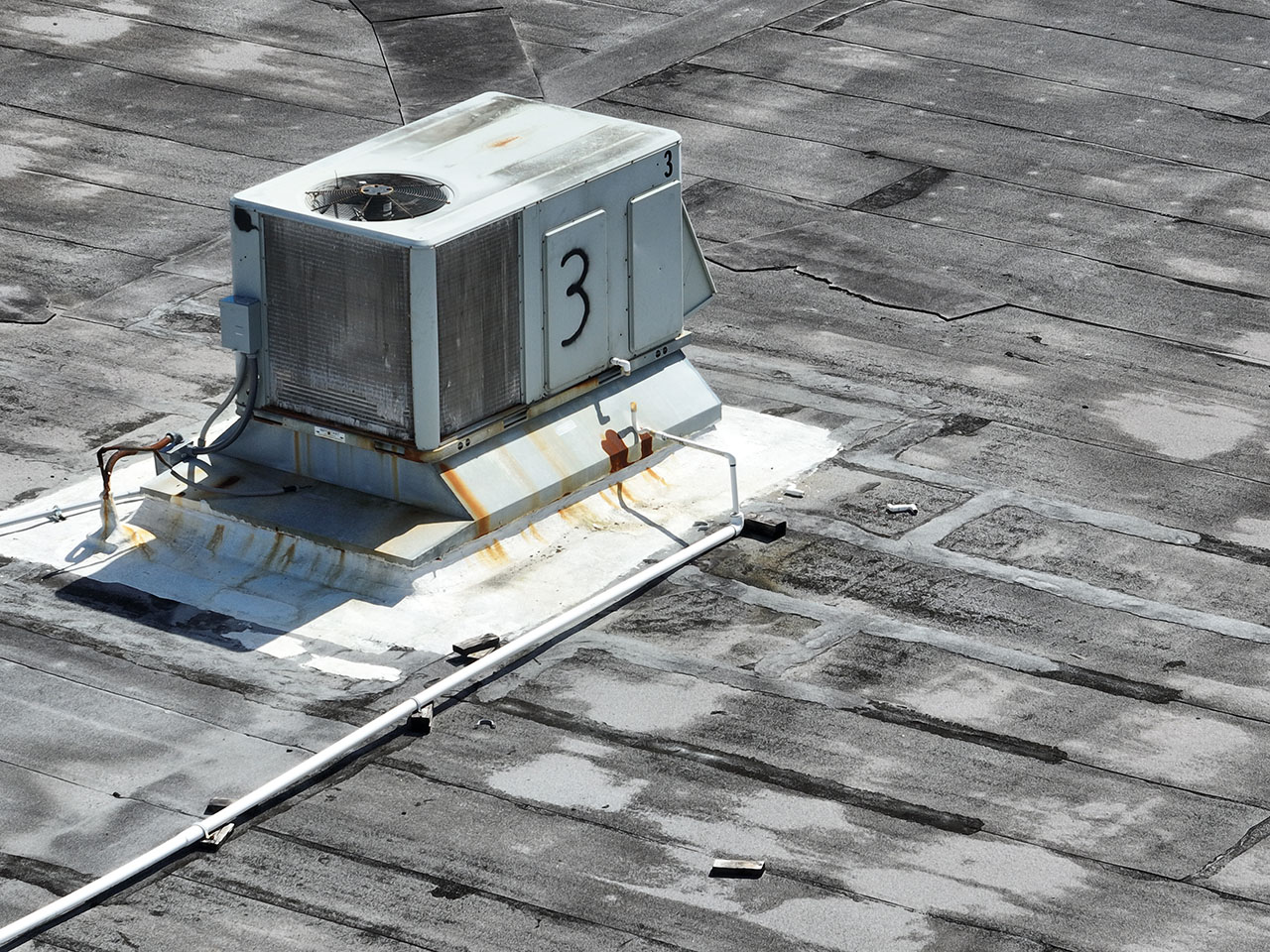
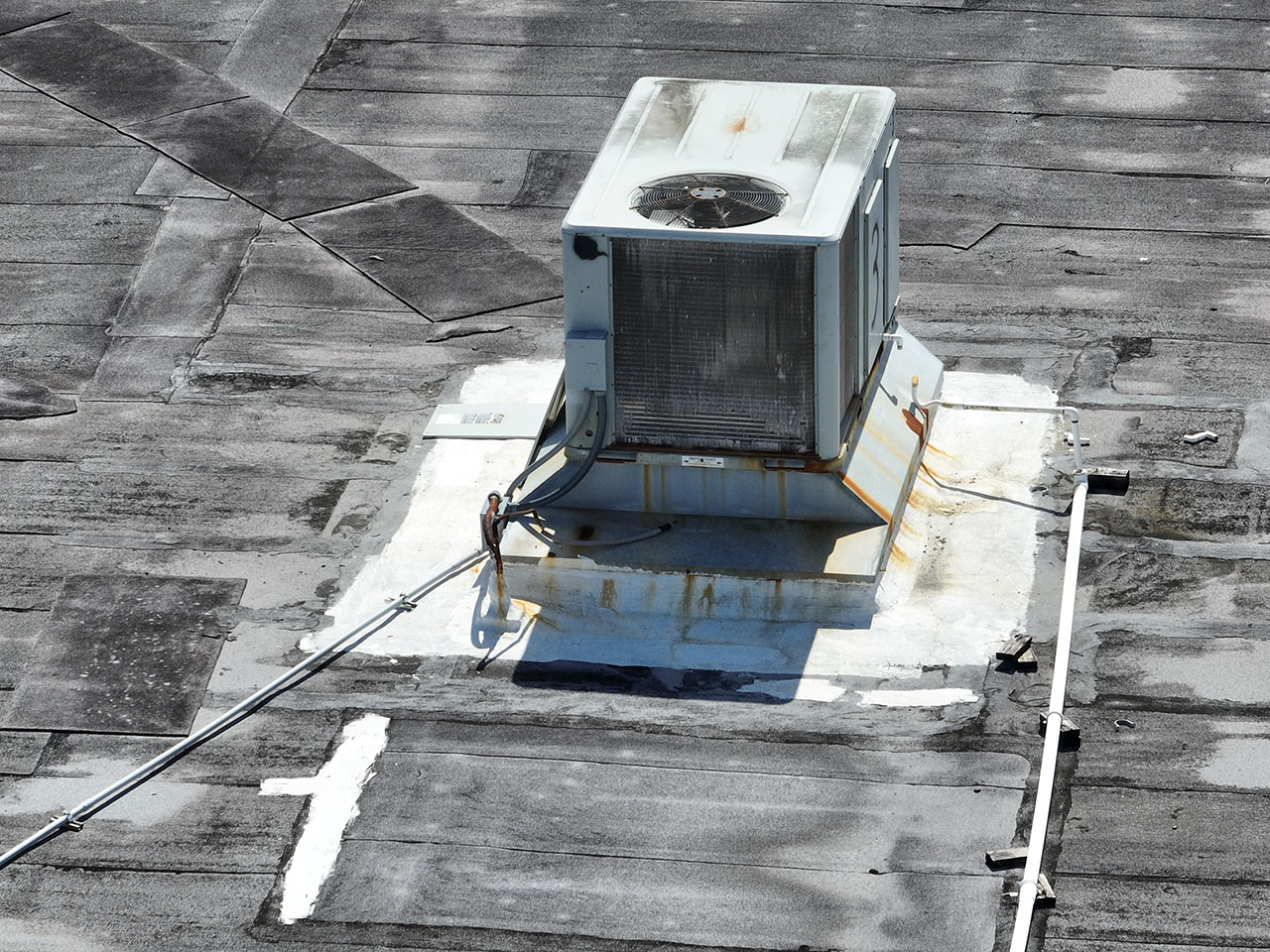
Insurance Claims
Drones are increasingly being used in the insurance industry to assess damage claims. Using drones can provide several benefits over traditional inspection methods, including:
Speed: Drones can quickly access hard-to-reach areas, allowing for a fast and efficient assessment of damage.
Safety: By using drones, inspectors can avoid dangerous situations, such as inspecting damage on a roof or in a hazardous area.
Cost-effectiveness: Using drones can be more cost-effective than hiring a team of inspectors or sending a manned aircraft.
Improved accuracy: Drones equipped with cameras and other sensors can provide high-resolution images and data, allowing for a more accurate assessment of damage.
Increased transparency: Drones can capture images and data that can be used to support and validate claims, increasing transparency and reducing disputes.
Overall, the use of drones in the insurance industry can help to improve the claims process, reducing costs and ensuring that claims are settled more quickly and accurately.
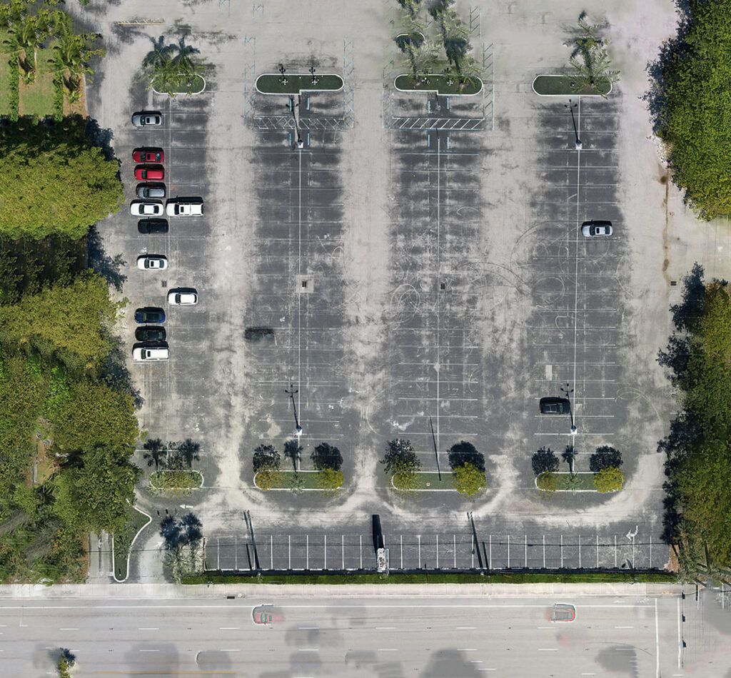
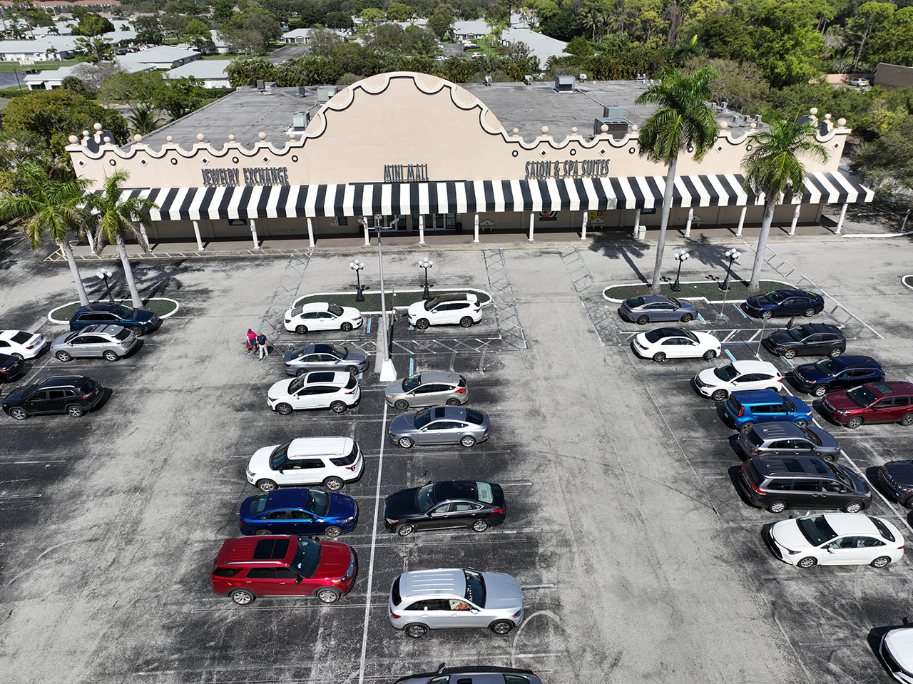
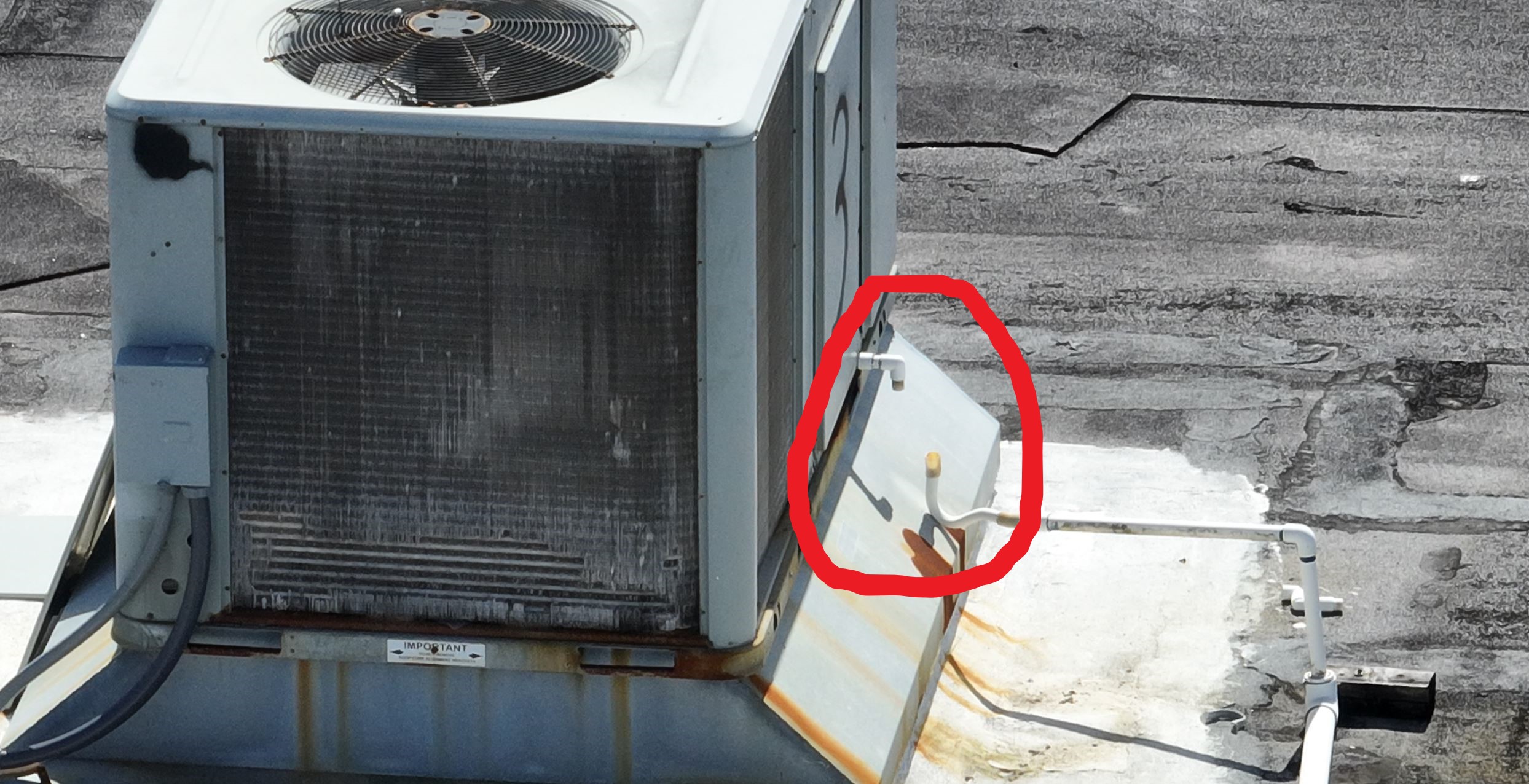
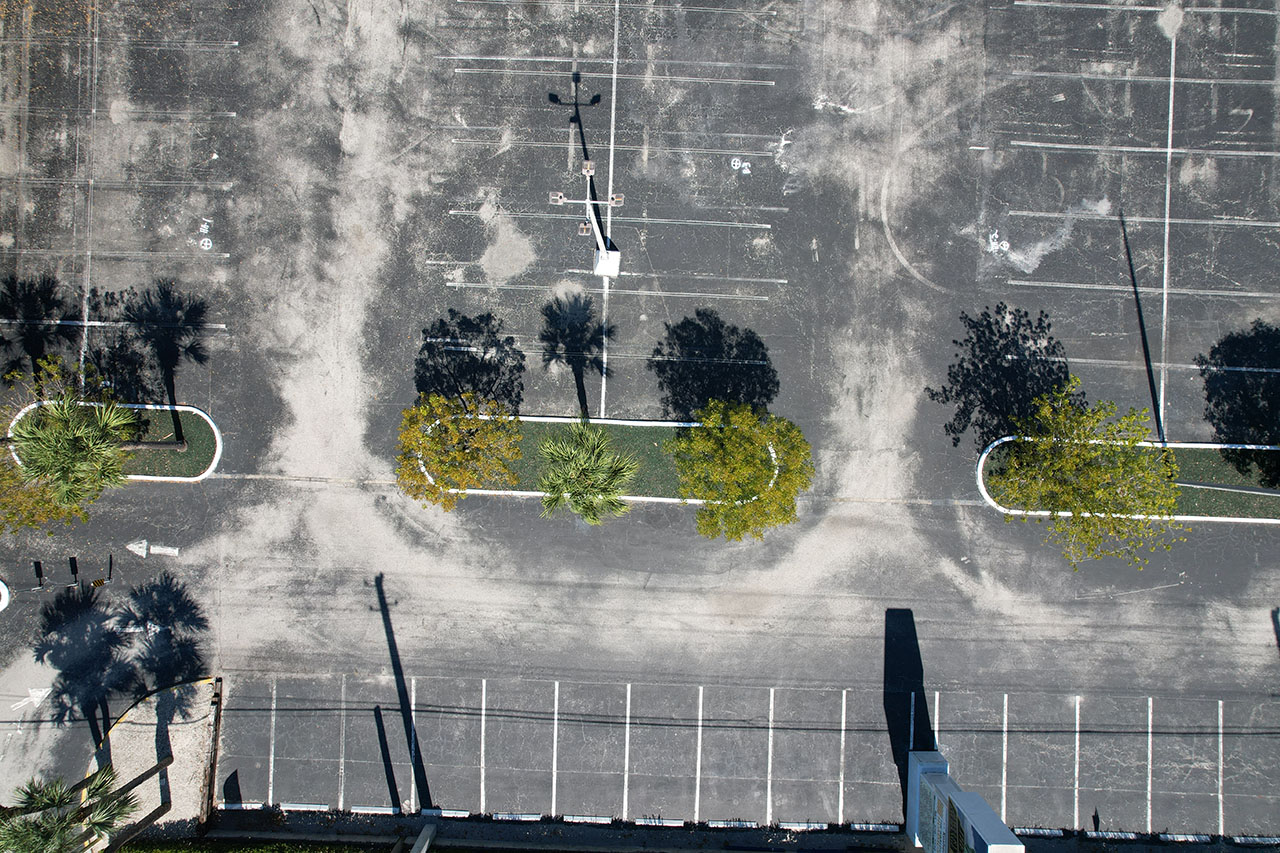
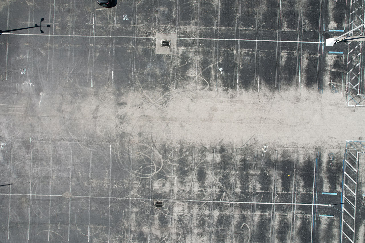
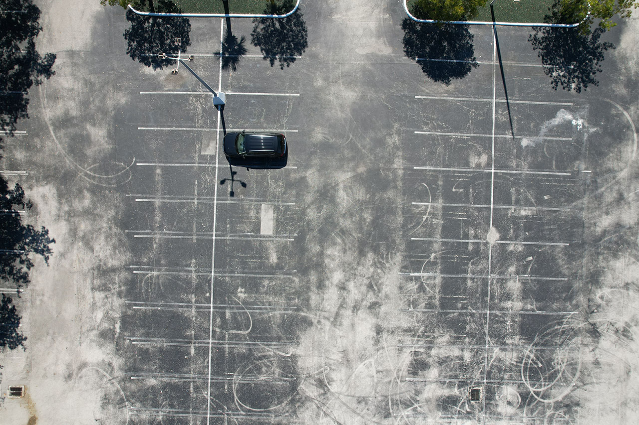
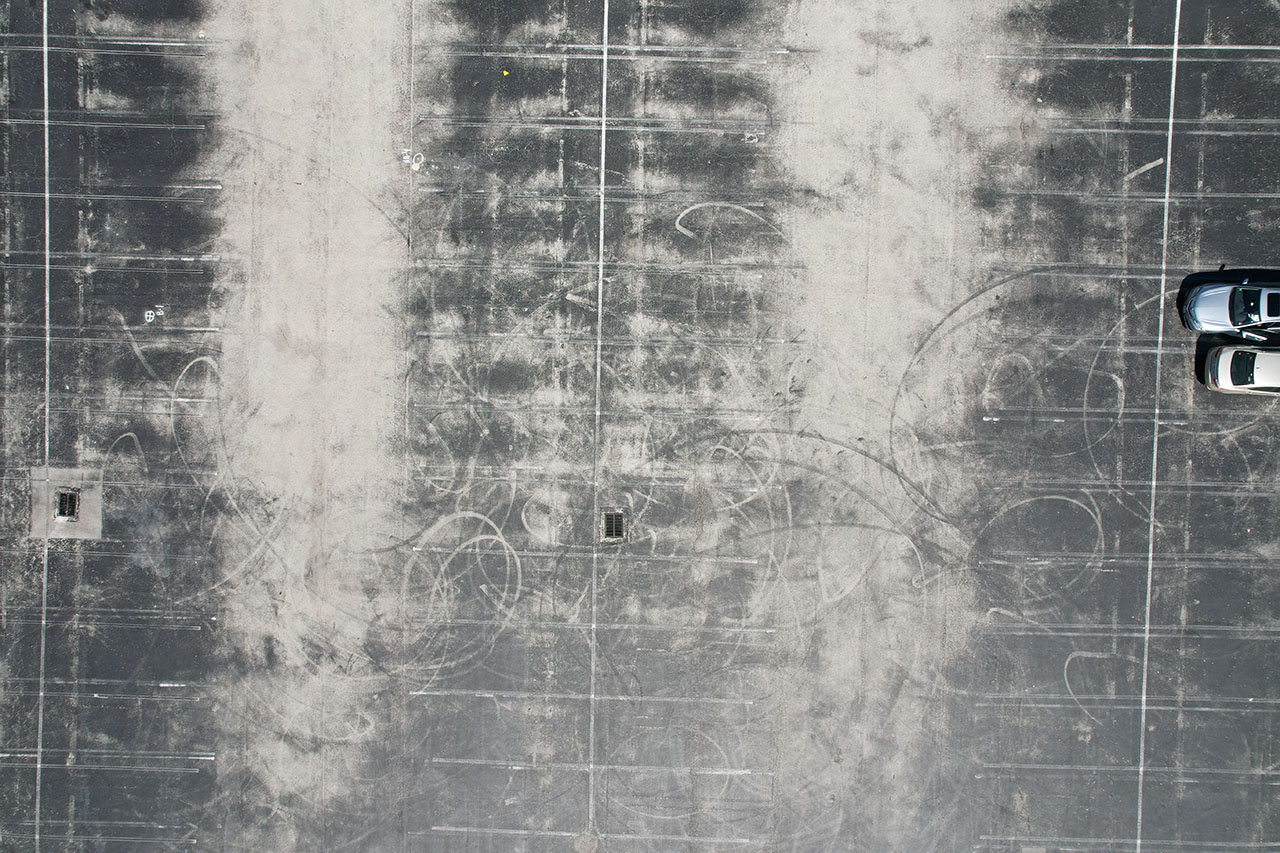
Parking Lot Inspections
Drones are being used for parking lot inspections for several reasons:
Speed: Drones can quickly survey a large parking lot, capturing images and data in a fraction of the time it would take for a manual inspection.
Cost-effectiveness: Sending a team of inspectors or using a manned aircraft to inspect a parking lot can be expensive. Using a drone can be a more cost-effective solution.
Improved accuracy: Drones equipped with high-resolution cameras and other sensors can provide detailed images and data, allowing for a more accurate assessment of the parking lot’s condition.
Increased efficiency: Drone inspections can be performed quickly and easily, reducing the amount of time required for the inspection and allowing for quicker decision-making.
Reduced disruption: Drone inspections can be performed without disrupting the normal flow of traffic in the parking lot, unlike manual inspections that may require the closure of sections of the lot.
Overall, the use of drones for parking lot inspections can help to improve accuracy, efficiency, and reduce costs and disruptions, making the inspection process more streamlined and effective.